 HOLT, Fla., Sept. 7, 2017, 10 p.m.–New hurricane warnings have been issued for Florida by the National Hurricane Center at the 11 p.m. EDT update.
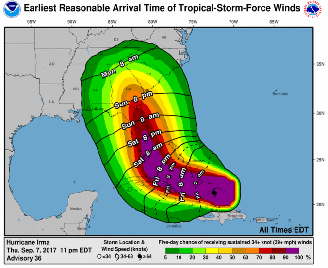
Warnings are for Jupiter Inlet southward around the Florida peninsula to Bonita Beach, the Florida Keys, Lake Okeechobee and Florida Bay.
Hurricane watches are in effect for north of Jupiter Inlet to Sebastian Inlet and north of Bonita Beach to Anna Maria Island.
Additionally, the five-day cone of predictability includes most of the Florida peninsula near the Panama City area.
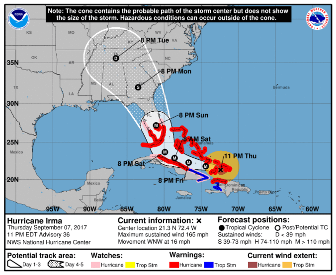
Irma is expected to continue on its current track and make a turn toward the northwest by late Saturday, according to the NHC.
Models indicate a very gradual decrease in Irma’s maximum winds up until a possible landfall in Florida, but the hurricane is nonetheless expected to still be at or near category four strength at that time.
After landfall, a fairly quick decay in maximum winds is expected due to land interaction and increased shear, although Irma’s large wind field is likely to still produce hurricane-force winds over a large area.