 HOLT, Fla., Feb. 7, 2018–Numerous showers and scattered thunderstorms are expected to increase in coverage across the region today ahead of a cold front.
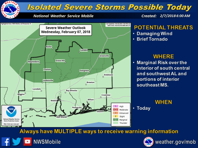
A few strong-to-marginally severe storms will be possible, mostly north and west of this area.
Some of the storms will produce locally strong, possibly damaging, gusty winds, frequent lightning and brief heavy rainfall which could lead to a limited potential of flooding in low-lying areas.
Damaging straight-line winds along with a brief tornado will be possible with some of the stronger thunderstorms.
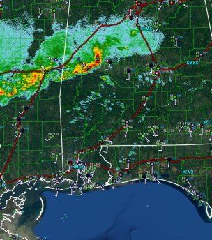
6:10 a.m. radar from the National Weather Service in Mobile
The storms will sag southeast across most of the remainder of the area today.
Winds will be south-to-southwest at 12-to-23 mph with slightly higher gusts this afternoon, becoming mostly north in the wake of the cold front this evening and overnight. Gusts from 36-to-46 mph will also be possible with some of the stronger thunderstorms today.
Highs today should reach 72 degrees with a low of 48 degrees tonight and clouds.
A few strong storms and locally heavy rainfall will be possible during the weekend and into early next week.
National Weather Service Mobile forecast
