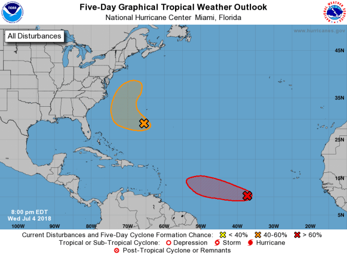
 HOLT, Fla, July 4, 2018–The low-pressure system located in the south tropical Atlantic Ocean continues to become better organized.
By the weekend, however, the National Hurricane Center expects the system to enter an area less conducive for development as it approaches the Lesser Antilles.
Located about 1,000 miles west-southwest of the Cabo Verde Islands, the system is moving west-northwest at 15-to-20 mph over the tropical Atlantic Ocean.
Formation through the next five days remains high at 70 percent, but upper-level winds carrying dry Sahara air and dust are expected to inhibit further development.
Elsewhere, disorganized showers and thunderstorms located a few hundred miles to the south and southwest of Bermuda are associated with a weak trough of low pressure.
Environmental conditions appear conducive for some development of this system, and a tropical depression could form before the end of the week while the system moves west-northwest and then north between Bermuda and the east coast of the United States.
The disturbance is then forecast to interact with a frontal system Sunday that will limit any additional development.
Further formation chance for this system is 50 percent.
National Hurricane Center forecast
