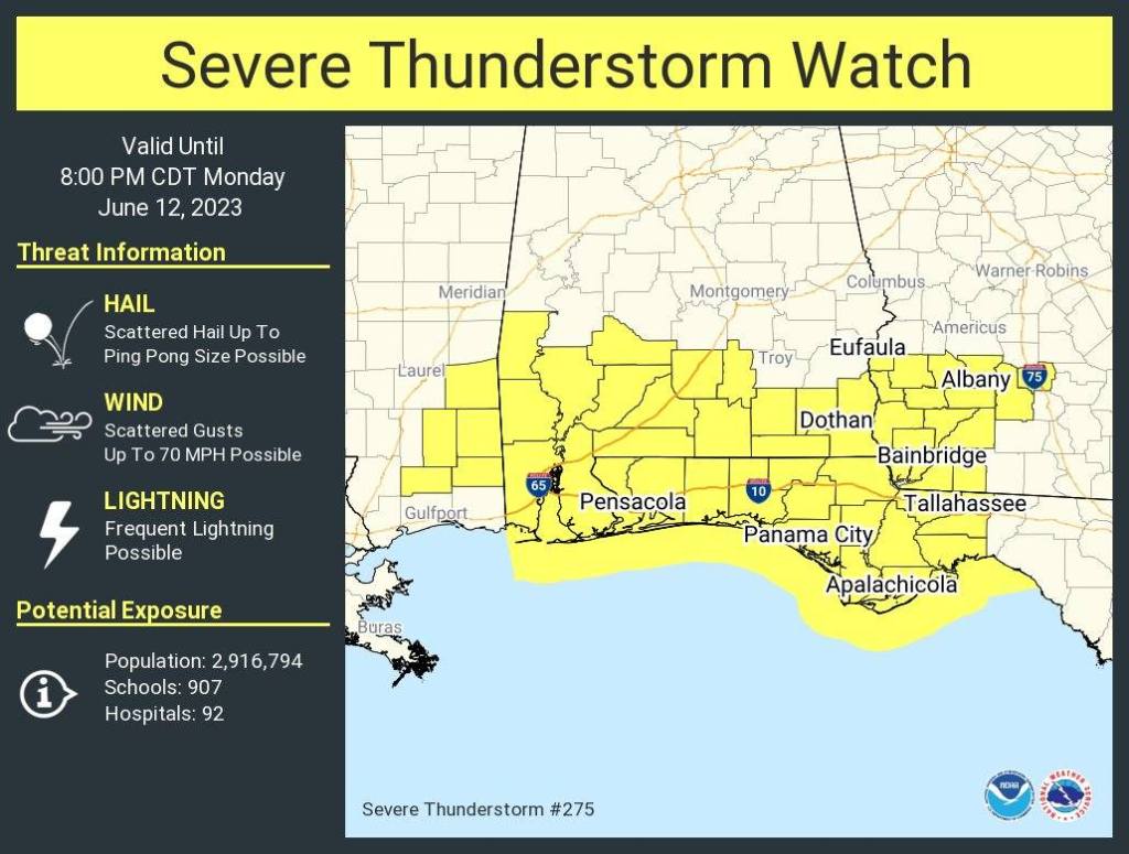
HOLT, Fla., June 12, 2022—The entire Florida panhandle and parts of lower Alabama are under a severe thunderstorm watch until 8 p.m.
Additionally, the entire National Weather Service Mobile weather forecast area is in a level 2 risk zone.
The morning started with a threat of a thunderstorm as skies blackened around 7 a.m. today, but the system moved toward the southeast with little activity here.
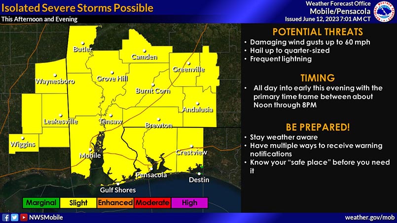
Additional storms, some of which could become severe, will develop throughout the day, especially during the afternoon and evening hours between 1-7 p.m., according to the NWS.
Damaging winds up to 70 mph, large ping-pong-ball-size hail, frequent lightning and heavy rainfall are all possible hazards in the strongest storms.
Rain changes continue through the week with 50 percent for tomorrow and 70 percent Wednesday and Thursday.
