
HOLT, Fla., June 13, 2023—More severe thunderstorms are expected to develop today throughout the region.
As of this morning, this area is in a level 1 risk for for severe weather while areas in north Okaloosa County are facing a level 2 risk.
According to the National Weather service, an isolated strong-to-severe storm or two will be possible with the best chance of development during the afternoon.
Damaging winds with gusts more than 60 mph and quarter-to-golfball sized hail will be the primary threat.
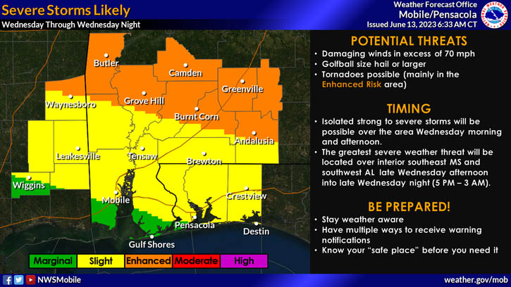
As it stands for tomorrow, northwest Florida will be under a level 2 risk as another round of severe thunderstorms increases across the region.
Areas further north in Alabama are facing a level 3 risk.
While strong isolated storms will be possible tomorrow morning, the greatest threat will be in the afternoon and into the evening.
Primary hazards are expected to be damaging winds in excess of 70 mph and golfball-sized or larger hail. Tornado development for both days is forecast to be low, but cannot be ruled out, according to the NWS.
