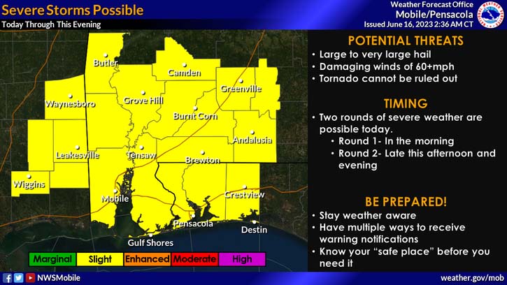
HOLT, Fla., June 16, 2023—Yet another day of severe weather is forecast for today.
This is the fifth consecutive day of severe weather and tomorrow appears to be another severe risk day.
The entire Mobile forecast area is again under a level 2 out of 5 risk for severe weather.
Additionally, Okaloosa, Santa Rosa and Escambia counties are under a severe thunderstorm watch until 10 a.m.
Multiple rounds of storms are expected across the region through this evening, according to the National Weather Service.
Primary threats today are expected to be damaging straight-line winds at 60-plus mph, large hail and heavy rain with cloud-to-ground lightning. The tornado risk is low, but not zero.
Yesterday’s heavy thunderstorm that occurred between 5 and 6 p.m. filled ditches alongside roadways which spilled out over the road creating driving hazards in the Baker area, especially on Galliver Cutoff where the speed limit is 55 mph.
A pickup truck traveling southwest roared through the standing water and hydroplaned a bit before the tires regained contact with the road. No accident occurred and no one was hurt in the incident.
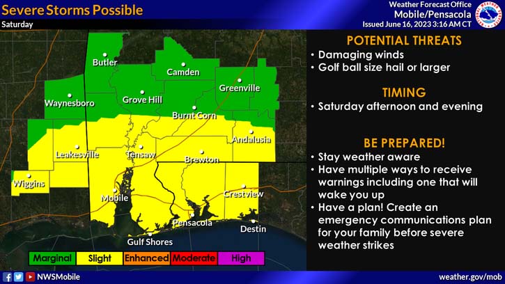
A severe weather risk continues into Saturday afternoon and evening which is lining up to be another level 2 risk day for the northwest Florida panhandle.
Primary threats are damaging winds of 60-plus mph and large hail.
Staff and NWS forecast
