
HOLT, Fla., June 17, 2023—Today marks the sixth consecutive day of severe weather following on the heels of a turbulent Friday.
According to the National Weather Service in Mobile, the risk continues through this evening with the ongoing threats of damaging straight-line winds of 60-plus mph, large hail and flash flooding. The tornado risk is not high, but it’s not zero.
The entire forecast area is again in a level 2 out of 5 risk zone.
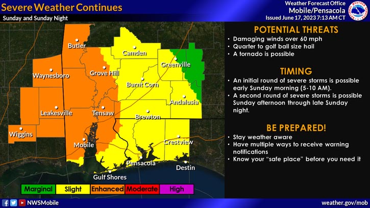
Additionally, tomorrow’s forecast is more of the same with another round of strong thunderstorms in the afternoon-to-evening hours.
Scattered-to-numerous thunderstorms will re-develop through the day today, some with the potential to become severe, according to the NWS.
A break from the weather will follow the afternoon storms before another round of storms moves through late tonight.
Additional rounds of storms will be capable of producing torrential downpours with the potential for 2-4 inches of rain with locally higher totals to fall in a short period of time, according to the NWS.
This can produce flash flooding, filling ditches that spill onto rural roads in the area making driving hazardous.
Staff and NWS forecast
