HOLT, Fla., July 9, 2023—Today will be an active day for showers and thunderstorms within the entire Mobile National Weather Service area.
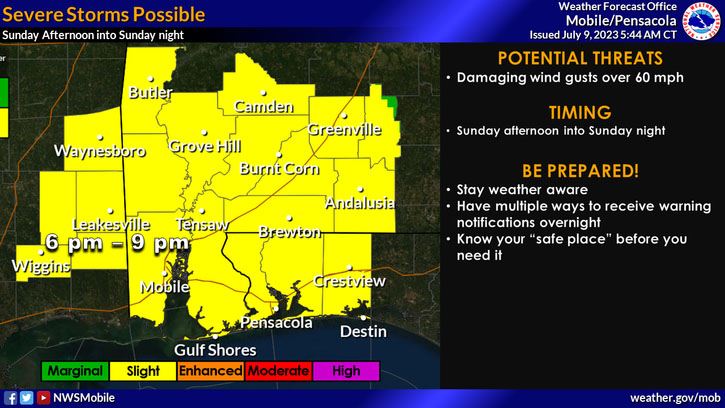
As a result, the area is under a level 2 risk for severe weather.
Numerous thunderstorms are expected this afternoon and evening.
Damaging winds with gusts up to 60 mph will be the primary concern with stronger storms, according to the NWS.
Frequent lightning and heavy rainfall can be expected with these storms.
Generally, one-to-two inches of rainfall is expected through tonight across much of the area, with locally three inches possible, according to the forecast.
A second round of potentially strong-to-severe storms could occur late this evening into the overnight hours, according to the NWS.
A tornado or two is possible with these storms, especially in southeastern Mississippi and southwestern Alabama.
Rain continues into tomorrow with an additional one-to-two inches of rainfall possible into the evening hours.
The chance of rain increases through the day to 90 percent with a 70 percent chance today and 90 percent chance again tomorrow.
NWS forecast
