
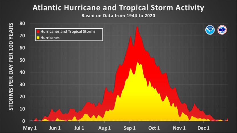
HOLT, Fla., July 28, 2023—Tropical wave activity is beginning to increase as the hurricane season moves toward the climatological peak of mid-August to early October.
In the central tropical Atlantic, a tropical wave located midway between the Cabo Verde Island and the Lesser Antilles is showing increased activity.
Environmental conditions are favorable for additional gradual development of this system in the next few days.
A tropical depression could form early next week as the system moves generally west-northwest.
Formation chance through the next seven days is medium at 60 percent.
For now, forecast models are showing this system turning north-northeast away from the eastern U.S. coast and remaining in the Atlantic.
This system will likely be identified as Invest 96 shortly.
The 8 a.m. tropical update showed two additional areas of interest being watched by the National Hurricane Center.
A disorganized area of showers and thunderstorms near the coasts of Georgia and northeastern Florida could bring heavy rainfall, but has a near zero chance of development.
This wave was identified earlier this week before it disappeared from the map.
A second area of storms associated with a tropical wave is forecast to move west over Central America later today or tonight.
This system at 10 percent also has a low chance of further development.
Neither will affect the United States beyond heavy rainfall.
