
HOLT, Fla., Aug. 26, 2023—Florida interests on the gulf coast are watching as a tropical system is forecast to develop in the next day or two.
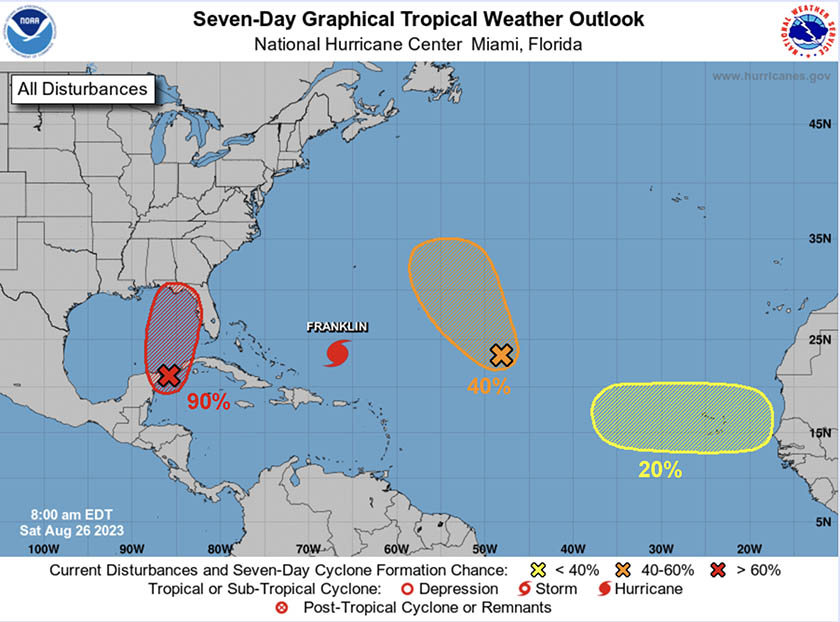
The National Hurricane Center has identified a low pressure system as Invest 93 located just off the northeastern coast of Mexico’s Yucatan Peninsula.
This system is moving northward over the southeastern Gulf of Mexico.
Environmental conditions—warm water, low wind shear, moist air—are favorable for this system to become Tropical Depression 10, Tropical Storm Idalia and possibly a hurricane after that.

Water temperatures in the Gulf of Mexico have climbed to its highest levels in recorded history this year, reaching the mid-to-high 80s, according to the National Oceanic and Atmospheric Association.
This is not only contributing to the extreme heat this summer but will add fuel to any tropical system that develops in the Gulf.
Hurricane models are indicating the system could reach the northern, northwestern or central western Gulf coast by early next week.
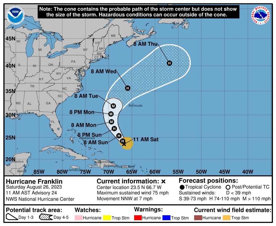
Hurricane Franklin
Further to the east, Tropical Storm Franklin has strengthened into the third hurricane of the season.
The NHC is forecasting Franklin to continue to strengthen into a category 3 storm, the season’s first major hurricane, by early next week.
While the storm is forecast to remain at sea, the eastern coast of the United States will likely experience stronger-than-normal currents and higher wave heights.
Atlantic activity
The low in the mid-Atlantic could become a tropical depression along the same timeframe as Franklin develops as the low moves into favorable environmental conditions.
It has a 40 percent chance of development during the next seven days.
Finally, a tropical wave is forecast to move off the west coast of Africa early next week.
Some slow development is expected while it moves westward across the eastern Atlantic. For now, it has a 20 percent chance of further development during the next seven days.

Pingback: Disaster preparedness sales tax holiday begins today | Holt Enterprise News