
HOLT, Fla., Aug. 28, 2023—The National Hurricane Center is forecasting for Tropical Storm Idalia to rapidly strengthen into a major hurricane prior to a Florida landfall this week.
Life-threatening storm surge and dangerous hurricane-force winds along portions of the west coast of Florida and the Florida Panhandle could begin as early as late Tuesday, according to the forecast.
According to the NHC, the tropical storm intensified overnight as it stalled over the waters just south of the Yucatan Channel between the peninsula and Cuba.
It is forecast to strengthen into a hurricane as it nears western Cuba later today.
Idalia will begin to intensify more as it starts to move north-northeast over the very warm 88-degree waters of the Gulf of Mexico, according to the NHC.
Rapid intensification is becoming increasingly likely before—and up to—a Florida west coast landfall and Idalia is forecast to become a category 3 storm over the eastern Gulf by early Wednesday.
The storm should make landfall sometime Wednesday.
As the storm parallels the west coast on its trek northward, only a small deviation in the track could cause a big change in the storm’s landfall location, according to the NHC.
Idalia is forecast to still be a hurricane as it crosses Florida toward Jacksonville.
Rain and flooding
Areas of flash and urban flooding, some of which may be locally significant, are expected across portions of the west coast of Florida, the Florida Panhandle and southern Georgia Tuesday into Wednesday, spreading into portions of the eastern Carolinas Wednesday into Thursday, according to the forecast.
The combination of a dangerous storm surge and the tide will cause normally dry areas near the coast to be flooded by rising waters moving inland from the shoreline, according to the NHC.
Should landfall occur during high tide, the Big Bend area could see 7-11 foot tides with 4-7 foot tides in Tampa Bay.
Portions of the west coast of Florida, the Florida Panhandle, southeast Georgia and the eastern Carolinas could see 4-8 inches of rain from Tuesday into Thursday. Isolated higher totals of 12 inches are possible, primarily near landfall in northern Florida.
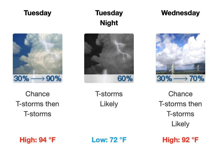
Rain chances increase today to 80 percent by this evening, 90 percent for tomorrow and 70 percent on Wednesday.
