HOLT, Fla., Jan. 13, 2024—Frigid weather is on the way for Tuesday and Wednesday.
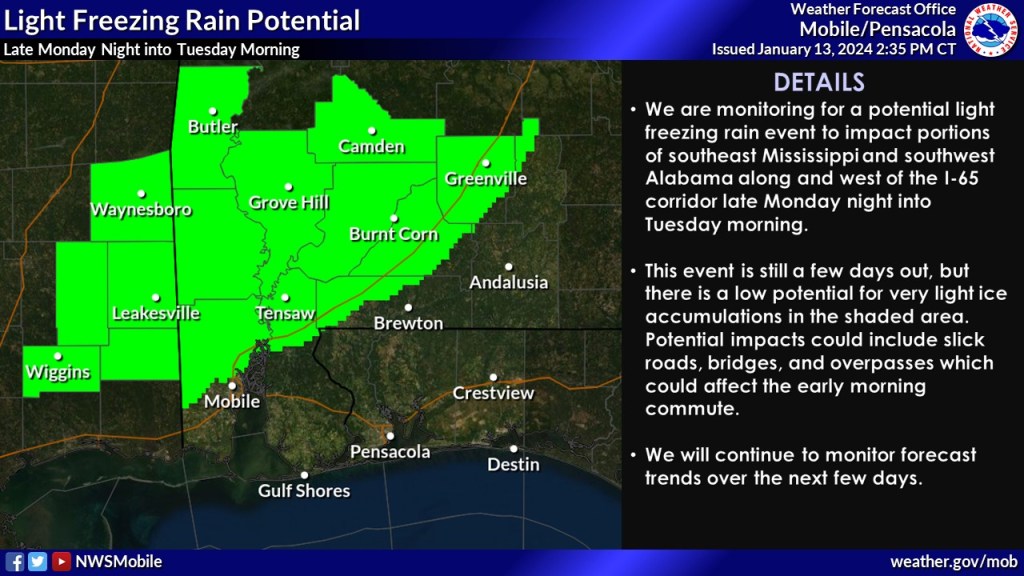
Areas north of Interstate 65 could see freezing rain while areas south of the interstate could see rain with a 20 percent chance between 10 p.m. Monday to 10 a.m. Tuesday, according to the National Weather Service.
The low Monday is forecast to be around 37 degrees.
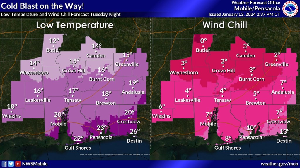
Cold air moving over the area in the wake of a strong cold front will bring below-normal cold days Tuesday and Wednesday as lows plunge to 20 degrees Tuesday night and 25 degrees Wednesday night. Expect hard freeze warnings and wind chill advisories from the National Weather Service.
These cold temperatures combined with a strong north wind will send wind chills into single digits throughout the area.
Wind gusts Monday night could get as high as 20 mph after midnight.
During the day Tuesday, north winds are expected around 10-15 mph with gusts as high as 30 mph. However, with a low around 20 degrees Tuesday night and north wind gusts at 25 mph, the wind chill will feel like it’s 3 degrees.
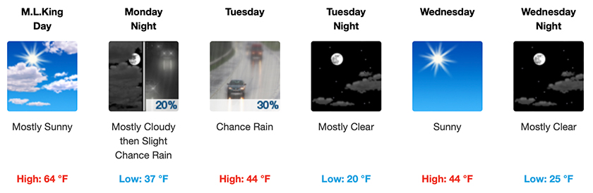
Wednesday, sunny skies and 44 degrees will plunge to 25 degrees after the sun goes down. Winds will be nearly calm at 5 mph with a wind chill around 19 degrees.
Rain chances return Thursday night and Friday with another arctic front forecast to move through the area next weekend.
