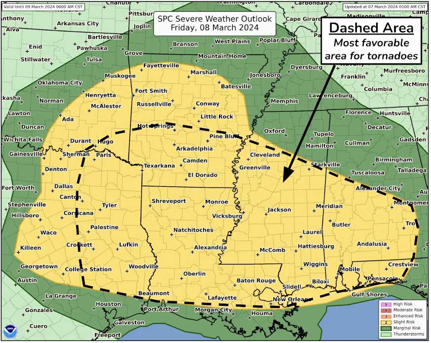
HOLT, Fla., March 7, 2023—A severe weather event is forecast to impact northwest Florida tomorrow evening into Saturday morning as a cold front moves through the area.
According to the National Weather Service’s Storm Prediction Center, a level 2 out of 5 severe weather risk could bring scattered severe thunderstorms, some with tornadoes and 55 mph damaging straight-line winds possible.
A severe weather system ahead of a cold front setting up over central Texas, Oklahoma and southern Kansas today will be making its way east, reaching the Mobile forecast area tomorrow.
Storms begin to move west into Louisiana around 6 a.m. tomorrow morning.
Once arriving here, periods of heavy rain could occur with widespread amounts of 1-2 inches and locally higher amounts, according to the forecast.
The chance of rain Saturday decreases from 70 percent to a 20 percent chance through tomorrow’s overnight hours.
Behind the front, dry conditions return late in the weekend through mid-week with mostly sunny skies Sunday and a high near 66 degrees, according to the NWS.
Highs Sunday will be in the mid 60s with lows behind the front dropping into the low 40s Sunday and Monday night.
Highs today will top out near 79 degrees with low clouds moving in later this afternoon and evening ahead of the cold front.
