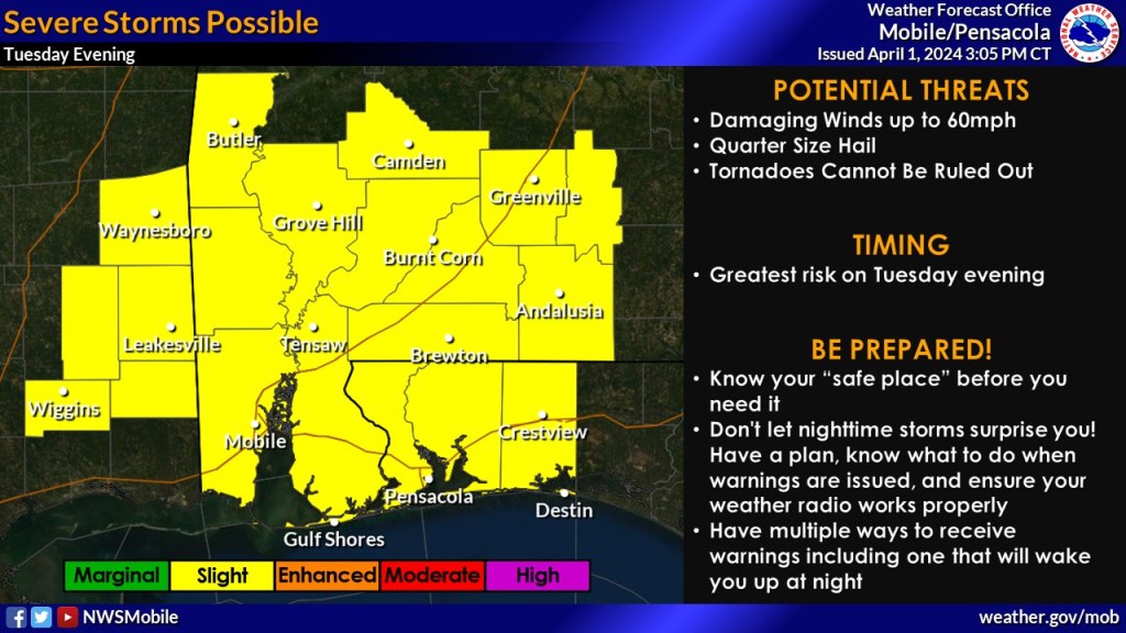
HOLT, Fla., April 1, 2024—The overall risk for severe weather tomorrow evening has increased across the entire forecast area.
The Storm Prediction Center now includes northwest Florida under a level 2 out of 5 risk for severe weather tomorrow.
Severe storms are possible with damaging wind gusts up to 60 mph being the primary threat. Quarter-sized hail is also possible with an outside chance of an isolated tornado, although tornado threat is low here, according to the NWS.
Timing for storms is generally between 9 p.m. tomorrow to 2 a.m. Wednesday.
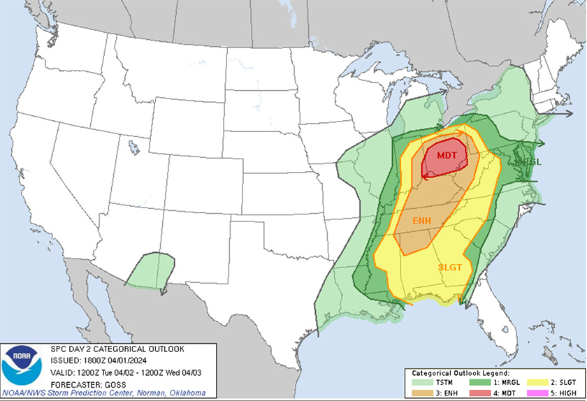
This weather is part of the severe weather system moving across the central plains area of Oklahoma and Texas, and into the Ohio River and Tennessee River valleys. Ohio is under an uncommon level 4 risk with baseball-sized hail, damaging winds up to 80 mph and the possibility of EF2+ tornadoes tonight and into tomorrow.
Chance of rain here tomorrow has increased to 70 percent, up from 50 percent in earlier forecasts.
Today’s 80-degree weather will drop to highs in the low 70s through Saturday with clear, sunny skies. Lows drop into the 40s Wednesday through Saturday.
Staff and National Weather Service forecast
