HOLT, Fla., May 12, 2024—There is a risk of severe weather tomorrow morning through early Tuesday morning.
The area is under a level 2 out of 5 severe weather risk; however, this could be increased to a level 3 during the early morning hours tomorrow.
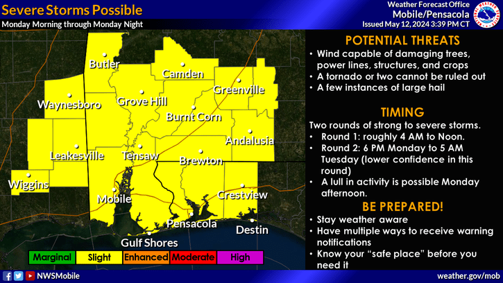
Storms could be capable of producing damaging straight-line winds, a few tornadoes and a few instances of large hail, according to the National Weather Service in Mobile.
Multiple rounds of showers and thunderstorms with very heavy rainfall will move across the western Florida panhandle early tomorrow morning through Tuesday afternoon.
Total rainfall could add up to 3-to-6 inches with locally higher amounts around 8 inches possible, according to the NWS.
These heavy rainfall amounts will bring an increased potential for flash flooding to the region. As a result, a flash flood watch will be in effect from tomorrow morning to Tuesday morning for the entire region.
The NWS is forecasting multiple rounds of storms. Round one is expected to cross into the area between 4 a.m. and noon tomorrow.
There could be a lull in activity possible Monday afternoon before round two moves into the area sometime between 6 p.m. tomorrow and 5 a.m. Tuesday.
A third band of thunderstorms are possible later Tuesday night.
NWS forecast
