
HOLT, Fla., May 13, 2024— Another day of severe weather is possible today with the most severe occurring over northwest Florida.
The Storm Prediction Center increased the severe weather threat for this area to a level 3 out of 5 due an elevated risk of severe storms that could pack 70 to 80+ mph wind gusts near and south of a stationary frontal boundary.
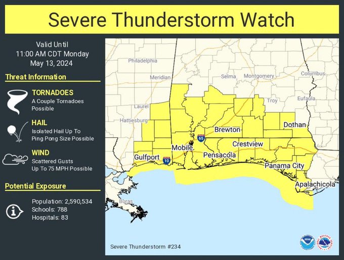
In addition to the flood watch in effect until 1 p.m. tomorrow, a severe thunderstorm watch is in effect today until 11 a.m.
The primary storm threat is damaging wind gusts and large hail along with heavy rain, especially along the Interstate 10 corridor. A few tornadoes cannot be ruled out, according to the National Weather Service.
Multiple rounds are expected today and this evening with a break from the weather later afternoon into early evening hours.
Rain in the forecast Friday through Sunday could bring more severe weather.
National Weather Service forecast
