
HOLT, Fla., Sept. 24, 2024—Tropical Storm Helene formed over the northwestern Caribbean sea late this morning.
Hurricane warnings in Florida have been posted from Mexico Beach southeast of Panama City to the Anclote River north of Tampa.
Warm sea surface temperatures and decreasing wind shear are likely to foster Helene’s rapid strengthening while it moves across the northwestern Caribbean Sea and eastern Gulf of Mexico, according to the National Hurricane Center’s forecast.
Hurricane models show Helene reaching major hurricane intensity while making its trek north. Current forecasts calls for winds to reach 115 mph making Helene a category 4 storm at landfall.
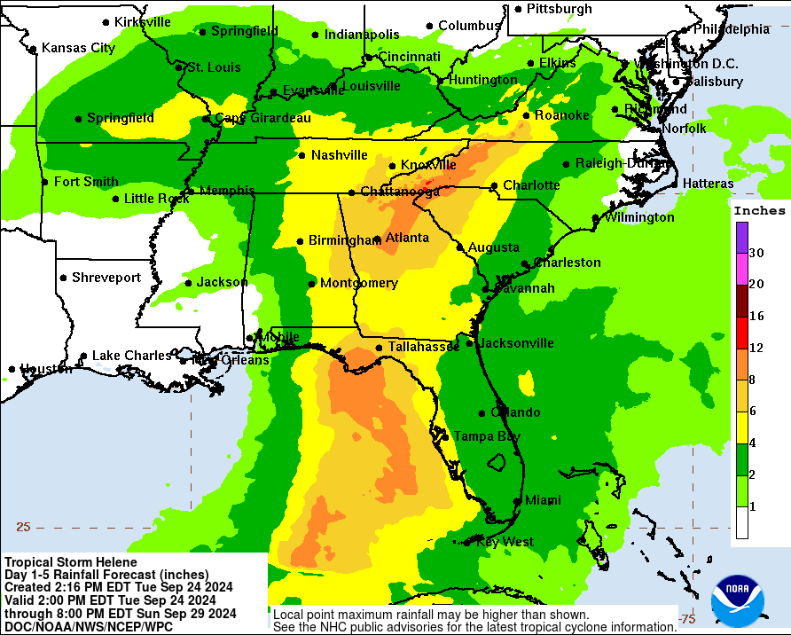
Due to the size of the storm, life-threatening storm surge along the entire west coast of Florida and the Big Bend area, along with wind and rainfall impacts will likely extend well away from the center and outside the forecast cone, especially on the east side, according to the NHC.
Because the storm will be moving quickly, its fast forward speed will likely result in hurricane impacts further inland into Florida after landfall. Hurricane warnings extend across the entire north central Florida with hurricane and tropical storm watches in southern Georgia.
Tropical storm conditions are expected to begin in the Big Bend area Thursday. This is the second hurricane to hit the Big Bend area. Hurricane Debby made landfall in the same general area early last month.
National Oceanic Atmospheric Administration and Air Force Reserve Hurricane Hunters will be investigating Helene this evening to provide more information about the storm’s intensity and structure.
Okaloosa County could receive 2-4 inches of rain through Sunday from Helene. The forecast for tomorrow is 70-80 percent chance of showers and thunderstorms with 80 percent chance tomorrow night into Thursday.
Staff and National Hurricane Center forecast
