HOLT, Fla., Oct. 6, 2024— A powerful hurricane with life-threatening hazards will be affecting portions of the Florida west coast around the middle of this week.
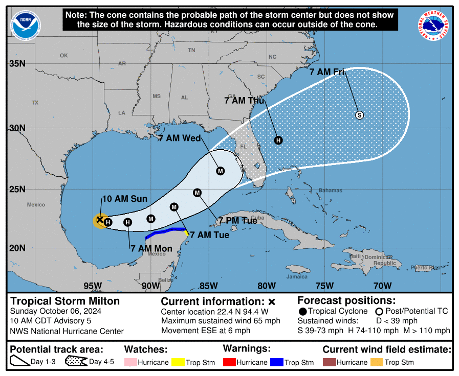
Satellite and aircraft data indicate Milton is strengthening, and according to the National Hurricane Center, the storm is forecast to strengthen into a hurricane today and intensify into a major system tomorrow, potentially reaching category 3 intensity prior to reaching Florida’s west coast Wednesday.
Milton’s track will take it over very deep warm Gulf waters with little wind shear for the next couple of days allowing the storm to rapidly intensify, according to the NHC.
The risk of life-threatening storm surge and damaging winds are increasing along the west coast beginning Tuesday night or early Wednesday.
Storm surge and hurricane watches could be issued later today or tonight, according to the hurricane center.
Areas of heavy rainfall will impact portions of Florida today and tomorrow well ahead of Milton, with heavy rainfall more directly related to the system expected later Tuesday through Wednesday night, bringing risks of flash, urban, rural and river flooding, according to the NHC.
Gov. Ron DeSantis has declared a state of emergency in 35 Florida counties, 13 of which were under a state of emergency for Hurricane Helene Sept. 23.
According to the declaration, computer modeling indicates rainfall prediction of 4-8 inches across the peninsula beginning as soon as Tuesday.
With the amount of rainfall across the state in the past 30 days, the level of soil saturation will likely lead to rapid onset of flash, urban and river flooding through next week. Heavy rainfall, flooding and gusty winds will cause power outages due to downed trees and powerlines, according to the declaration.
Interstates, roads, bridges, airports, schools, hospitals and power grids already affected by Hurricane Helene could feel additional impacts from Milton.
Although Milton will weaken after landfall, it is forecast to maintain hurricane strength by the time it exits the peninsula on the east coast. Northern east coast Florida areas could experience strong winds, heavy rainfall and storm surge behind the storm as the system’s winds shift from southwest to northeast.
Staff and National Hurricane Center forecast
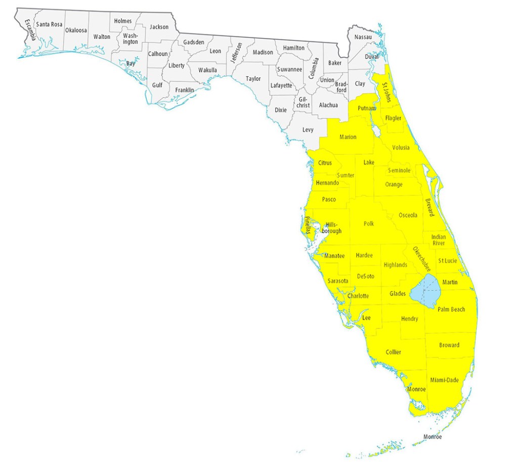
Counties included in state of emergency:
- Brevard
- Broward
- Charlotte
- Citrus
- Collier
- DeSoto
- Flagler
- Glades
- Hardee
- Hendry
- Hernando
- Highlands
- Hillsborough
- Indian River
- Lake
- Lee
- Manatee
- Marion
- Martin
- Miami-Dade
- Monroe
- Okeechobee
- Orange
- Osceloa
- Palm Beach
- Pasco
- Pinellas
- Polk
- Putnam
- Sarasota
- Seminole
- St. Johns
- St. Lucie
- Sumpter
- Volusia
