
HOLT, Fla., Dec. 28, 2024—An outbreak of severe thunderstorms is expected mainly during the evening and through the overnight hours today.
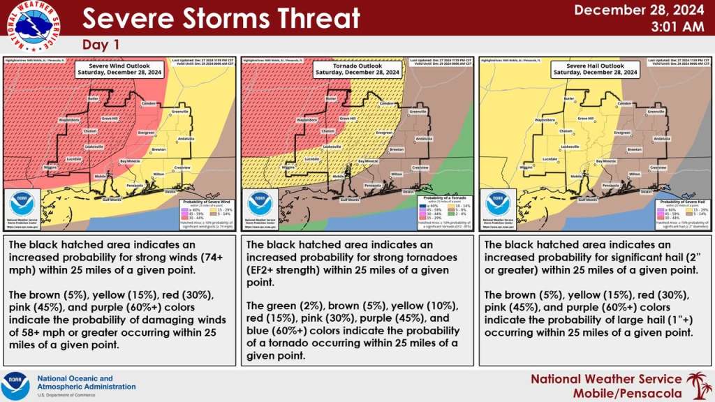
The worst of the weather will be focused primarily along and west of the Interstate 65 corridor in Alabama, which could consist of several strong and long-track tornadoes, damaging winds in excess of 70 mph and large hail.
Okaloosa, Santa Rosa and most of Escambia counties are in a level 2 risk zone for severe weather. Areas to the west in Alabama are in a level 3 with portions of Mississippi in a level 4 risk zone.
The heavy showers and thunderstorms that moved through earlier this morning have left the area. All that remains is a steady light-to-moderate rain across the western panhandle that will eventually ease off, allowing the area to briefly dry out later today, according to the Mobile National Weather Service forecast.
A severe thunderstorm/tornado outbreak is anticipated for a large portion of the Mobile forecast area, according to the forecast.
The forecast calls for two rounds of storms. The first round will be scattered storms during the afternoon and into the evening hours. However, according to forecasters, this round may not fully develop.
A second round is expected to develop during the overnight hours with the potential for winds in excess of 70 mph, some strong tornadoes and large hail, mainly west of the I-65 corridor, according to the forecast.
Rains will taper off tomorrow morning and skies will gradually clear. Highs will be near 75 degrees. Sunday will be mostly clear with a low near 47.
The rest of the week will be sunny. Lows New Year’s Eve will drop into the low 40s. A high near 62 degrees is forecast for New Year’s Day. The coolest days will be Thursday through Saturday with highs in the 50s, according to the forecast.
National Weather Service Mobile forecast
