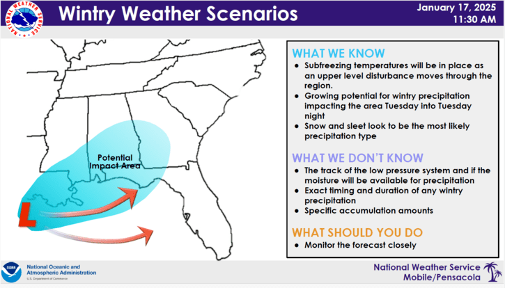
HOLT, Fla., Jan. 17, 2025—Confidence continues to increase for a winter weather event for the Florida panhandle next week.
Timing is primarily from early morning Tuesday into Tuesday evening.
Wintry precipitation could impact the area; however, according to the National Weather Service in Mobile, this is far from certain and there are still things that could result in a drier forecast.
It will be COLD
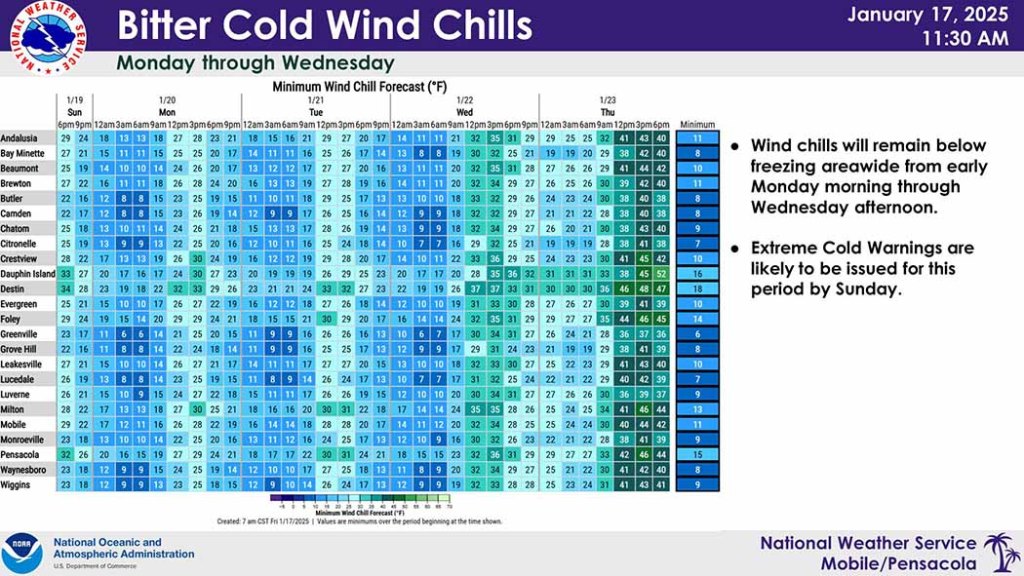
What is confident is that it will get bitterly cold. Sub-freezing temperatures will be in place across the region with temperatures 15°-20° below seasonal average.
According to forecasters, if winter weather does not materialize, lows could drop even lower.
Lows will be bitterly cold Sunday night through Wednesday night. Winds forecast for those day will be between 10-15 mph with 20-25 mph gusts, dropping wind chills to the mid-to-lower teens here Monday, Tuesday and Wednesday mornings.
This will result in a hard freeze across the entire area, including the coast. The NWS encourages everyone to plan now to protect people, pets, pipes and plants.
Actual air temperatures may not get above freezing across much of the area Tuesday, especially if there is precipitation.
Snow, sleet, freezing rain
Chances of seeing impactful winter weather have increased, according to the NWS.
While the confidence in wintry precipitation is increasing, it is still a little early to know what type of precipitation will occur—it could be snow, sleet or freezing rain, or a mixture of all types.
While it is becoming more apparent that there will be some accumulations, forecasters say it is too early to indicate specific amounts.
It’s also possible there will be no precipitation, according to the NWS.
Temperatures should gradually warm by the middle-to-latter part of the week. Wednesday, Thursday and Friday highs will increase from 40° Wednesday to a high near 51° Friday.
NWS forecast
