HOLT, Fla., Jan. 19, 2025— Winter storm impacts are expected Tuesday morning into the evening hours.
Conditions will likely deteriorate throughout the day Tuesday, according to the National Weather Service in Mobile.
Snow, mixed with sleet and or freezing rain in some areas, will make driving hazardous. Additionally, frigid temperatures will drive wind chills into the low teens or lower.
Possible snow
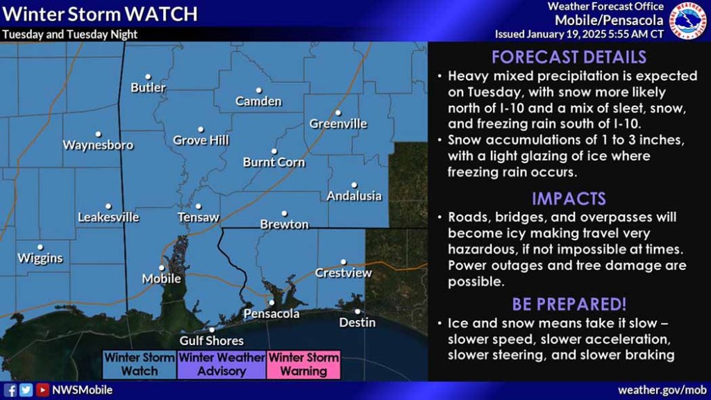
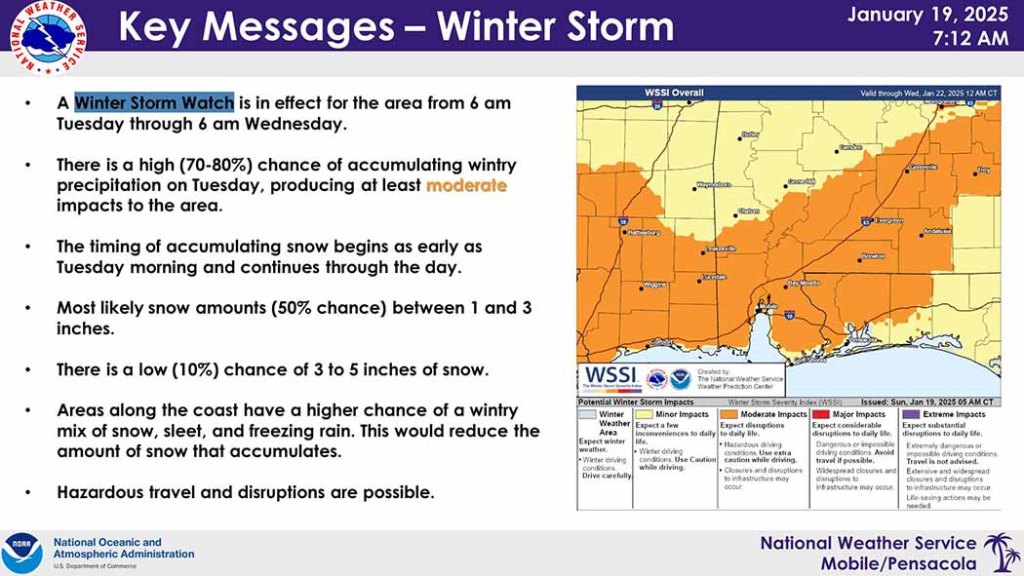
A winter storm watch is in effect for the forecast area from 6 a.m. Tuesday through 6 a.m. Wednesday.
Mixed precipitation is forecast with snow likely north of Interstate 10 with snow, sleet and freezing rain south of the interstate.
According to the NWS, there’s a 50 percent chance of snow accumulation between 1 and 3 inches with lower amounts near the coast. There is a lower 10 percent chance of exceeding 3-5 inches of snow.
The bitter cold will likely allow accumulation on roadways. Roads, bridges and overpasses will become icy making travel hazardous. Trees and powerlines could come down due to ice accumulation in some areas.
Any lingering wintry precipitation will end by Wednesday morning and the remainder of the forecast will be cold and dry, according to the NWS.
Cold
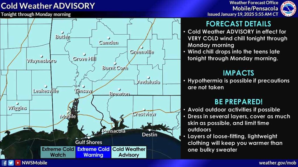
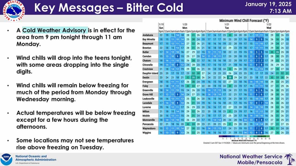
Cold air will begin moving into the area today. A cold weather advisory is in effect from 9 p.m. tonight until 11 a.m. tomorrow and will likely be updated throughout the next few days.
Wind chills will remain near or below freezing, dropping into the teens each night, beginning tonight through Wednesday.
Highs for today in the low 50s have already been reached. Temperatures will begin to drop through the rest of the day.
Tonight will be clear and cold with a low around 23°. Winds will be out of the north at 10-15 mph with 25 mph gusts driving wind chills into the low teens.
According to the NWS, the cold weather advisory may be upgraded to an extreme cold watch for the overnight period tonight.
NWS forecast
