HOLT, Fla., March 13, 2025—The northwest Florida panhandle is forecast to experience multiple rounds of severe weather during the next few days.
The most significant weather will happen Saturday, but rain is in the forecast today as well.
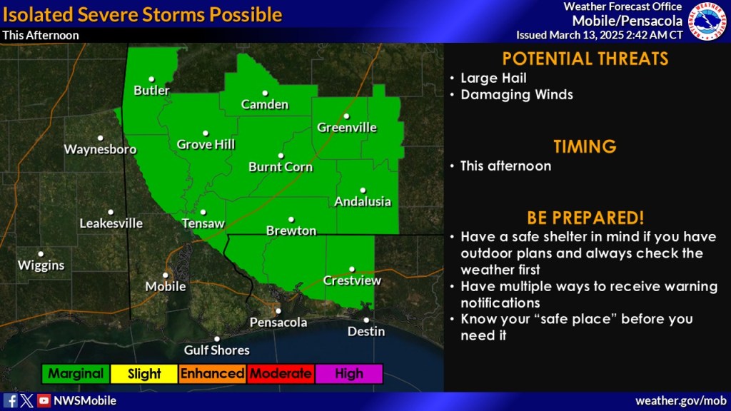
Most of northwest Florida is under a level 1 out of 5 threat of severe storms today. A 50 percent chance of rain today could produce isolated strong-to-severe thunderstorms, mostly around mid-afternoon here.
Main threats with any severe storms that develop will be quarter-sized hail and damaging winds, according to the National Weather Service.
Tomorrow is forecast to be partly sunny here, while counties to the west will again be under a level 1 severe weather risk. Much of the severe weather activity will occur north of Florida in Mississippi and northwest Alabama.
As of today’s forecast, Crestview is not expected to receive rain tomorrow.
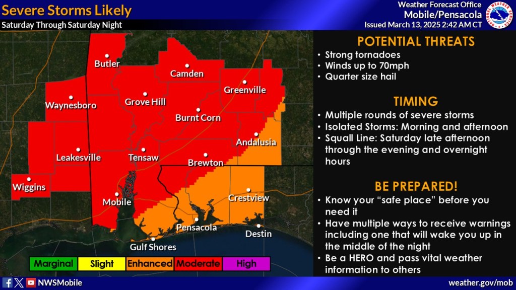
The main severe weather event begins Saturday, driven by the risk of strong tornado activity, according to the NWS.
Most of northwest Florida, with the exception of northern Escambia County and a corner of northwest Santa Rosa County, will be under a level 3 severe weather risk, as of today. However, the forecast could be updated between now and Saturday to include this area in the level 4 risk.
Multiple rounds of severe storms are expected Saturday. According to the NWS, supercells are possible through the afternoon ahead of a squall line that will sweep across the area.
All threats will be possible with these storms—strong long-track EF2+ tornadoes, damaging winds and large hail.
Timing is forecast to be between noon Saturday to 3 a.m. Sunday.
The next chance for showers and storms will be late next week, according to the forecast.
The NWS stresses to prepare now for Saturday’s weather event by having a safe shelter in mind and multiple ways to receive warnings, including during the middle of the night.
