
HOLT, Fla., March 14, 2025—A tornado outbreak is likely across the entire Mobile forecast area that includes northwest Florida.
According to the National Weather Service, numerous significant tornadoes, some that could be long-track and potentially violent, are possible.

Additionally, the NWS’s Storm Prediction Center has identified this area as having the greatest risk for strong tornadoes as well as 2-plus-inch hail. Okaloosa County and areas east could also see 75 mph or higher winds.
Because of this significant risk, the SPC has elevated tomorrow’s severe weather risk to a rarely used level 5 out of 5 for areas in central western Alabama and central eastern Mississippi. The governor of Alabama has issued a state of emergency for all 67 counties.
According to the SPC, these storms will be fast-moving and extremely dangerous.
Local meteorologist Spinks Megginson of Red Zone Weather said this is only the third time since 2007 that part of the Mobile forecast area has been under a level 5 risk zone.
In the 2007 storm, also in March, one of two EF4 tornadoes in Alabama tore through the high school in Enterprise, Ala.
Northwest Florida remains in a level 4 risk area. Although the level 5 risk area has the greatest potential for tornado activity, the entire area could see strong long-track destructive tornados, according to Megginson.
For tomorrow, scattered thunderstorms are expected to develop during the afternoon hours consisting of strong to potentially violent long-track tornadoes, damaging to destructive winds and large hail.
This round will come in two waves with scattered thunderstorms during the afternoon west of this area followed by a broken squall line during the evening hours here, according to the forecast.
Although the forecast for the northwestern part of the area has an elevated risk, the NWS advises that people not focus on where the high risk is located. All areas could experience dangerous weather.
Storms should diminish from west to east during the overnight hours Saturday into early Sunday morning, according to the NWS.
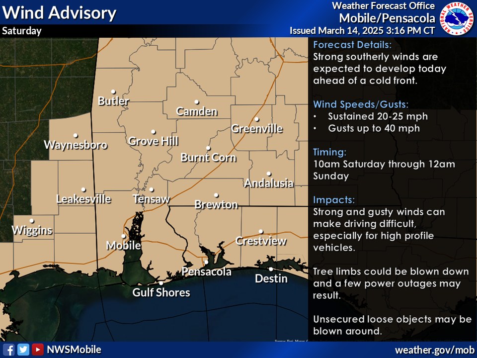
Outside of thunderstorms, it will be windy across the area. A wind advisory will be in effect from 10 a.m. to midnight tomorrow. Sustained winds of around 20-25 mph, with gusts to around 40 mph can be expected.
While it doesn’t affect this area, it should be noted that a high surf warning will be in effect from noon tomorrow to 6 a.m. Sunday for large breaking waves of around 7-9 feet.
For tonight, isolated thunderstorms are forecast to develop late this evening into the overnight hours for areas west of Interstate 65.
Any storms that do develop will be capable of producing damaging winds, large hail and a few tornadoes, according to the NWS.
The forecast for here is mostly cloudy with a low around 64 degrees. Winds will be from the south at 10-15 mph with gusts as high as 25 mph.
Spinks Megginson
If a tornado warning is issued, Megginson will go live on Facebook and track the tornado to keep viewers informed of the danger until the emergency is over.
Staff and NWS forecast
