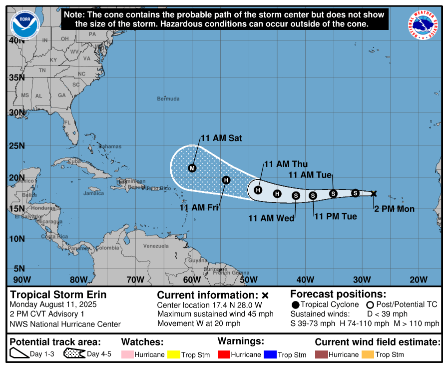
HOLT, Fla., Aug. 11, 2025—Tropical Storm Erin has formed in the eastern tropical Atlantic Ocean this morning.
The National Hurricane Center determined that Invest 97 has organized enough to become a tropical storm, the fifth of the 2025 hurricane season.
Erin, moving west near 20 mph, is expected to follow this track for the next several days.
Gradual strengthening is forecast as it makes its way westward.
For now, the NHC forecast is for Erin to become a hurricane midweek, the first of the 2025 season, and intensify to 115 mph—major storm strength—by the end of the five-day forecast period.
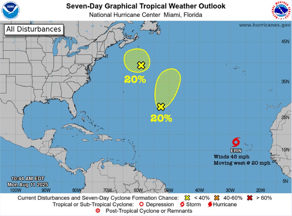
The NHC has also been watching a weak low pressure area over the central Atlantic; however, significant development of this system is becoming unlikely and the possibility of further formation has been reduced to 10 percent.
Additionally, a third area of non-tropical low pressure is located a few hundred miles south-southeast of Nova Scotia, Canada.
As this low travels over the warm Gulf Stream waters, it has a 10 percent chance of developing some tropical or subtropical characteristics. By the middle of the week, however, it will be back over cooler waters, ending its chances for further tropical development.
National Hurricane Center forecast
