
HOLT, Fla., Nov. 24, 2025—A cold front moving through the area has the potential to bring severe weather early tomorrow into tomorrow night.
For now, northwest Florida is under a level 1 severe weather risk for possible tornado activity.
According to the Mobile’s National Weather Service, two rounds of severe weather can be expected tonight and tomorrow with tornadoes, localized damaging wind gusts and isolated large hail possible.
Any severe storm that can organize will be capable of producing localized damaging wind gusts and a tornado, according to the NWS.
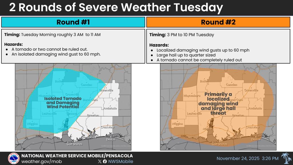
The first round of showers and thunderstorms are expected tomorrow morning around the 3-11 a.m. timeframe with the highest risk of storms along and north of Interstate 65. A tornado or two are possible in this level 2 risk area.
The second round is expected to be area wide around 3-10 p.m. tomorrow afternoon/evening.
The primary threat will be localized damaging wind gusts and quarter-sized hail, according to the NWS.
Temperatures will drop behind the cold front. A freeze is possible closer to the I-10 corridor Friday morning.
Wednesday night lows will be in the low 40s; Thursday and Friday night lows will be in the mid-30s. Highs will be in the low 60s on Thanksgiving and Friday.
Rain returns to the forecast Saturday night through Monday.
Staff and Mobile National Weather Service forecast
