HOLT, Fla., Jan. 8, 2026—There is a low-end potential for severe weather tomorrow into Saturday ahead of a cold front that is forecast to move across the area.
For now, the risk level is 1 out of 5 for severe weather.
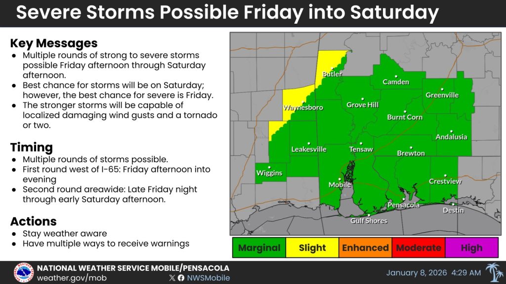
According to Mobile’s National Weather Service, the best potential for severe storm development appears to be over the extreme northwestern portion of the forecast area tomorrow into the evening hours.
Severe storms are expected mainly along and west of Interstate 65 tomorrow, then will move across the entire area Saturday, according to the NWS.
The system is forecast to bring high rain chances. Dry conditions will develop Saturday night.
Unseasonable warm temperatures will continue through Saturday before lows drop into the lower 30s Sunday, Monday and Tuesday nights, according to the NWS.
Skies will be partly sunny Sunday and mostly sunny Monday and Tuesday before rain returns to the forecast Tuesday night and Wednesday.
Staff and National Weather Service Mobile forecast
