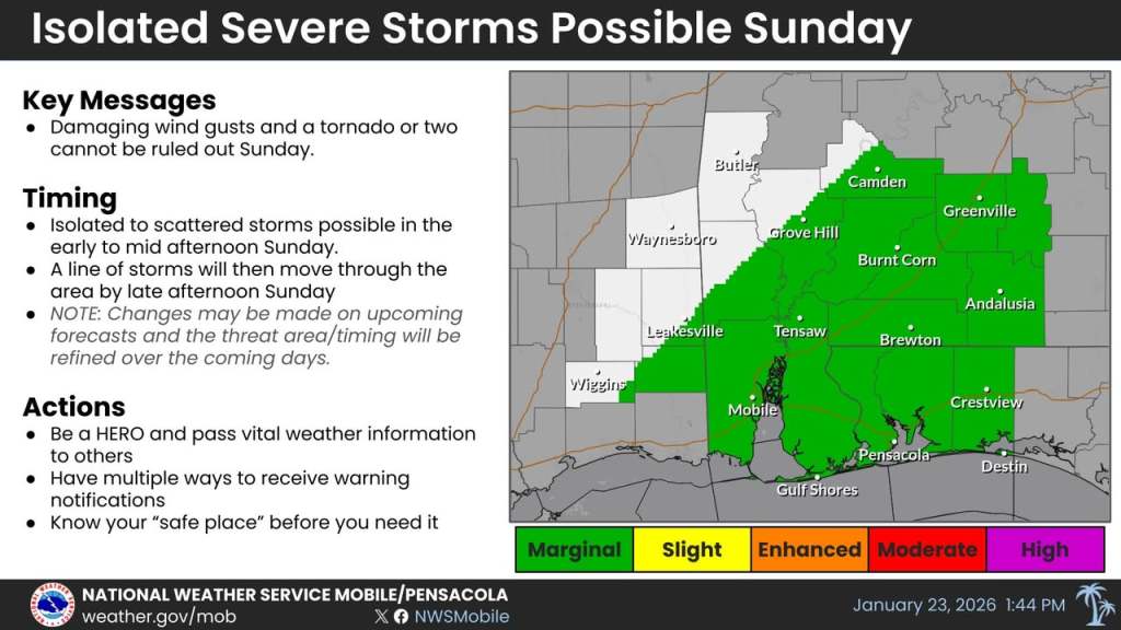
HOLT, Fla., Jan. 23, 2026—Strong-to-severe storms are possible Sunday ahead of a strong cold front moving across the area as part of the huge winter storm system affecting the United States.
The northwest Florida panhandle will be in a level 1 out of 5 risk area ahead of the approaching cold front.
According to Mobile’s National Weather Service, a wind advisory may be needed Sunday for winds of 20-30 mph with higher gusts.
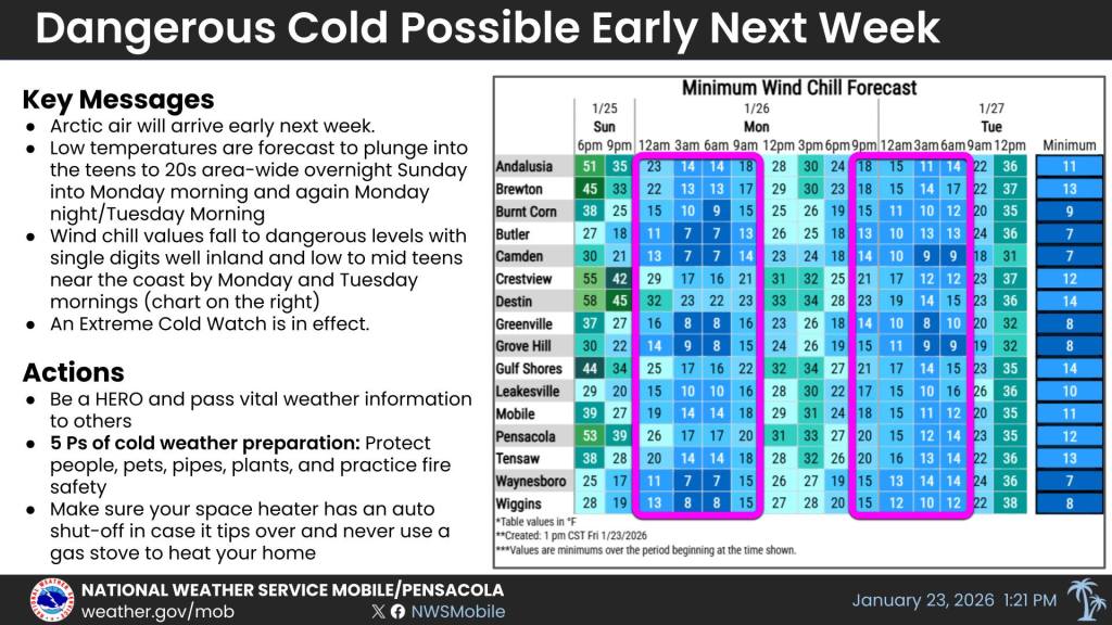
An extreme cold watch is in effect for the entire area Sunday night into Monday morning and will likely be needed again Monday night into Tuesday morning as dangerously cold temperatures and wind chills move into the area Sunday night and again Monday night, according to the NWS.
Overnight temperatures could dip into the teens to lower 20s with wind chill values both nights likely dropping into the teens here.
There is a concern about the potential for black ice to develop due to lingering water on roadways that could freeze as arctic air rushes into the area behind the rains.
Although strong winds will dry most of the roadways, bridges and overpasses will be the most susceptible, according to the NWS.
Staff and National Weather Service
