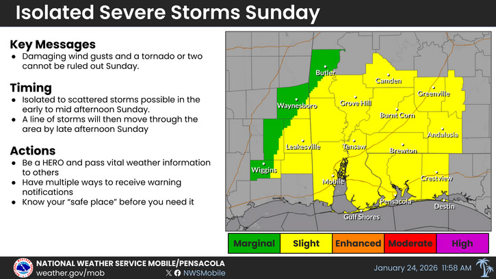
HOLT, Fla., Jan. 24, 2026—The risk of severe weather tomorrow for the northwest Florida panhandle has been elevated to a level 2 out of 5 as a cold front moves through the area.
A line of storms capable of isolated damaging wind gusts or a tornado or two will move across the area during this period of unstable weather, according to Mobile’s National Weather Service.
Arctic air arrives behind the front as temperatures rapidly drop Sunday evening into the upper 20s during overnight hours here.
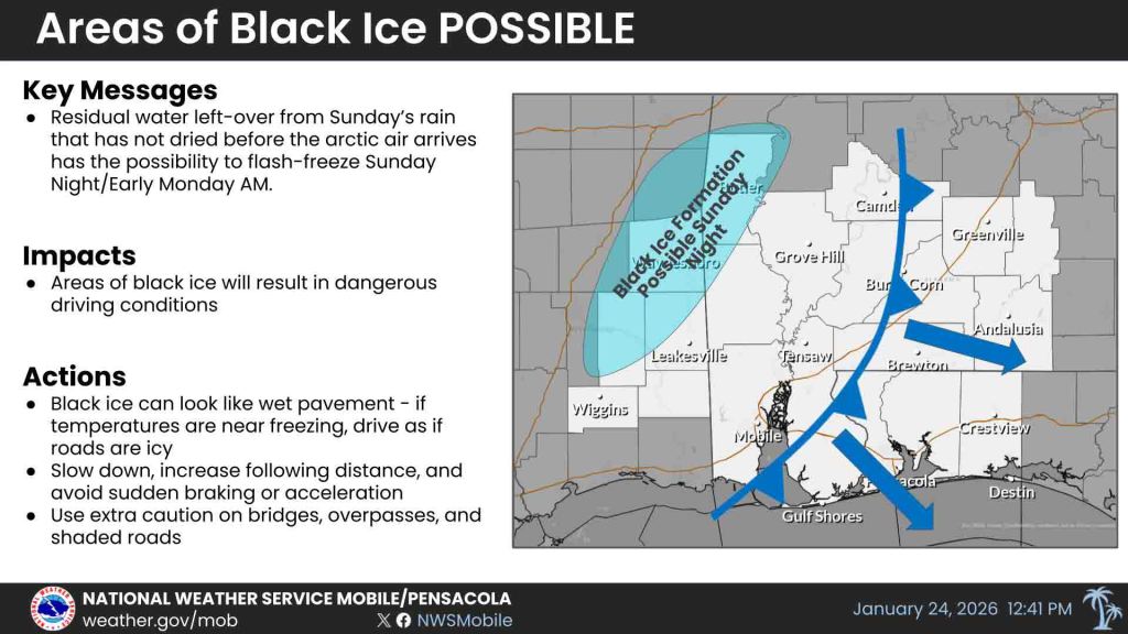
Depending on how much it rains tomorrow and how quickly temperatures drop, some black ice could form on bridges and overpasses in southeastern Mississippi and interior southwest Alabama. It will be a race for roads to dry before temperatures plummet to freezing and below, according to the NWS.
Wind chills will plummet into the teens to single digits and an extreme cold watch is in effect from late tomorrow night through Monday morning.
Cold weather will persist Monday night through overnight hours during the rest of the week as temperatures drop into the teens and 20s in most areas north of Interstate 10 and low 20s south of the interstate.
Cold overnight temps:
- Sun 27°, NW wind 10-15 mph w/25 mph gusts, wind chill 21°- 16°
- Mon 19°, north wind 5-15 mph w/20 mph gusts, wind chill 13°- 4°
- Tue 22°, NW calm-5 mph winds, wind chill around 13°
- Wed 27°, NW wind 5 mph, wind chill around 20°
- Thu 24°
- Fri 27°
Staff and National Weather Service Mobile forecast
