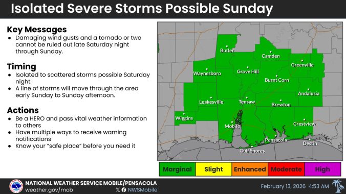
HOLT, Fla., Feb. 14, 2026—There is a low-end level 1 risk of severe weather across northwest Florida ahead of a clash between warm and cold fronts tomorrow.
According to Mobile’s National Weather Service, there will likely be two rounds of severe weather, should it materialize.
The first round is forecast to arrive here early to mid-morning. The primary threat with this line of thunderstorms is the potential for damaging winds up to 60 mph or higher, according to the NWS.
There may be a brief lull after the main line of storm passes, but by the afternoon, a second round of showers and storms is possible that could produce brief tornadoes and small hail as the primary threats.
Gusty winds as high as 25-35 mph are forecast across the area beginning early tomorrow morning. Winds should begin to die down by midafternoon.
Behind the front, temps will be above seasonal average, reaching near 80 degrees later in the week.
