
HOLT, Fla., Aug. 1, 2024— A tropical system that could impact Florida’s gulf coast is forecast to develop this weekend or early next week as a well-defined tropical wave moves west-northwest across Haiti and Cuba.
For now, the National Hurricane Center has identified a cone of development associated with Invest 97 that covers nearly the entire state of Florida.
The northwest Florida panhandle is not yet included in the cone as of the latest tropical outlook map. However, yesterday’s map did not include the panhandle. Today’s map has been shifted west and subsequent maps will likely include all of the northwest panhandle.
When, where and how intense a system will develop is still unknown.
Nearly all hurricane models are predicting a tropical system developing. Model intensity guidance is indicating a system as strong as a category 2 hurricane could develop.
The NHC has formation chance of development as medium at 60 percent.
Ingredients for a hurricane
Hurricane development depends on a number of conditions: warm water, moist atmosphere, low vertical wind shear.
When all these align, a tropical system can develop.
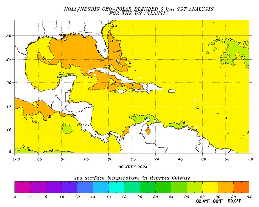
Conditions right now are highly favorable for tropical development. Sea surface temperatures in the Caribbean Sea and northeastern Gulf of Mexico are well above normal, in the mid-to-high 80s and higher near the coast.
Because hurricanes draw energy from high surface water temperatures, these high temperatures add fuel to a developing storm.
The NHC is describing Invest 97 as a “robust tropical wave” and future updates including increased chances of development are expected.
