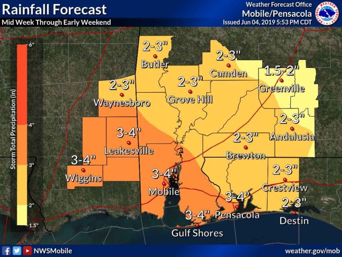
Weekend rainfall totals are expected between 2-to-3 inches in this area. (National Weather Service)
HOLT, Fla., June 4, 2019—The recent hot-and-dry weather pattern that’s been hovering over this area is about to end.
According to the National Weather Service, rain chances are on the rise the next few days and will keep daytime high temperatures a little cooler—80s instead of 90s-to-100s.
Scattered rain showers and storms Wednesday with periods of heavy rain is possible late in the week through early in the weekend.
Total rainfall could be between 2-to-3 inches through early this weekend with Friday being a washout in terms of heavy rain chances, according to the NWS.
For Wednesday, there’s a 30 percent chance of scattered showers and thunderstorms in the afternoon with a high expected of 92 degrees.
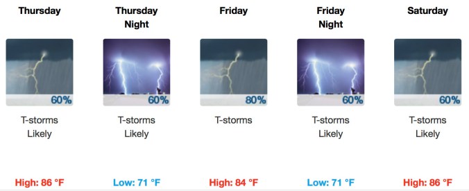 Rain chances increase Thursday through Saturday with some areas likely to see higher rain totals.
The change in the weather is partially due to tropical moisture associated with the western Gulf of Mexico tropical disturbance that never fully developed in to a larger system.
Regardless of development into a tropical storm, the low-pressure system is expected to bring periods of locally heavy rainfall across the forecast area.
NWS forecast
