 HOLT, Fla., June 6, 2019—Numerous-to-widespread showers and thunderstorms will continue to develop across the area tonight.
Some storms will be capable of producing very heavy rainfall within a short period of time, especially along the western Florida panhandle, where a flash flood watch is in effect through tonight, according to the National Weather Service.
Isolated severe storms will be possible through early this evening. Damaging winds and a brief tornado will be possible.
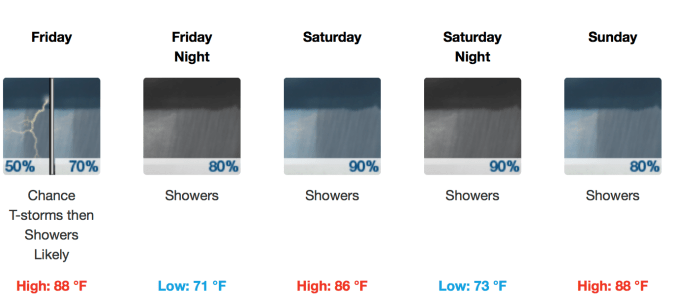
More heavy rain is expected Friday.
This weather pattern will continue Friday through the weekend.
Several rounds of heavy rainfall will be possible through Sunday and storm total rainfall amounts of 3-to-5 inches are forecast.
A few of the stronger storms will also be capable of producing brief strong wind gusts and frequent lightning strikes.
Last night, 3-to-6 inches of rain fell across the forecast area. A local Holt rain gauge registered nearly 2 inches by 9 a.m. with another 3 inches by 9 p.m.
A flash flood watch is in effect until 7 a.m. Friday.
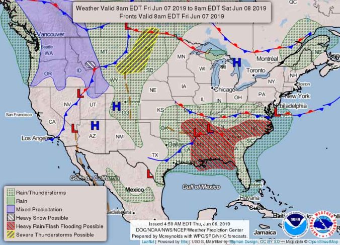
National Weather Service forecast
