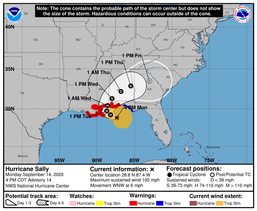
HOLT, Fla., Sept. 14, 2020—Sally has increased its intensity to 100 mph sustained winds making it a category 2 hurricane.
The storm is creeping west-northwest at 6 mph through an environment with low wind shear and warm gulf waters that should allow for additional strengthening tonight while the system moves over the north-central Gulf of Mexico, according to the National Hurricane Center.
Sally could approach major hurricane strength making it a dangerous hurricane when it moves onshore, according to the NHC.
Even after landfall, Sally is forecast to have 105 mph winds, making it a category 1 hurricane before weakening into a strong tropical storm.
The storm is forecast to remain on its west-northwest track through the night before turning north, then northeast tomorrow through Wednesday night.
Landfall is expected late tomorrow night or early Wednesday.
Hurricane warnings have been extended from the Florida/Alabama state line eastward to Navarre.
A tropical storm warning is in effect from Navarre to the Big Bend area of the Florida panhandle.

A flash flood watch remains in effect until Thursday morning and includes the Blackwater River in Baker.
A flood warning is in effect for Blackwater River, Big Coldwater Creek and Shoal River.
Hurricane-force winds extend outward up to 25 miles from the center and tropical-storm-force winds extend outward up to 125 miles.
This area could begin experiencing tropical-storm-force winds as early as 8 p.m. tonight and hurricane conditions by late tomorrow and tomorrow night.
Heavy rains associated with Hurricane Sally are expected to spread into the area beginning tonight and will continue over the watch area through at least Thursday morning.
Given the uncertainty in the timing and location of the northward turn and the lack of well-defined steering currents, residents are reminded to not focus on the exact forecast track or the specific timing and location of landfall.
Hurricane-force winds, dangerous storm surge and flooding rainfall will affect a large portion of the north-central Gulf Coast during the next few days.
What to expect
- Frequent tropical-storm-force winds with gusts to 50 mph through Wednesday night
- Prolonged periods of heavy rain through Wednesday with 6-to-10 inches
- Possibility of a few tornadoes through Wednesday
- Major river flooding through Friday
