Rain and cooler temperatures are expected for Thursday. (National Weather Service Mobile)
HOLT, Fla., Nov. 8, 2017—Rain and cooler temperatures are forecast for tonight into the weekend according to the National Weather Service in Mobile.
A cold front pushed southward across the region this afternoon, and was located roughly along a line from just south of Gulf Shores, to near Pensacola Bay to between Crestview and Destin as of 3 p.m.
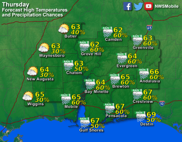
Rain associated with the front will begin sometime after midnight and quickly come to an end by Thursday afternoon, according to the NWS Mobile.
Rainfall amounts are not expected to be very heavy tonight into Thursday morning, with totals mostly expected to average between 0.25 and 0.5 inches.
Cloudy and cool conditions are expected with northerly winds through the period.
Lows tonight should range from around 50 to the mid 50s. Highs Thursday are only expected to reach into the lower-to-mid 60s.
Significantly cooler temperatures are expected Thursday night. Overnight lows Thursday will trend a little cooler than normal for a change with inland lows falling into the low-to-mid 40s and upper 40s to low 50s closer to the coast.
Daytime highs under mostly clear skies should reach the upper 60s to low 70s Friday and Saturday. Overnight lows Friday into Saturday morning will continue to be a little on the cool side.
Temperatures Saturday night will rebound into the 50s as a more easterly to perhaps even east-southeasterly winds allow a return of moisture and warmer air into the area in advance of a weakening cold front.
National Weather Service Mobile forecast
