 HOLT, Fla., March 3, 2019—The National Weather Service is forecasting significant weather for the forecast area today.
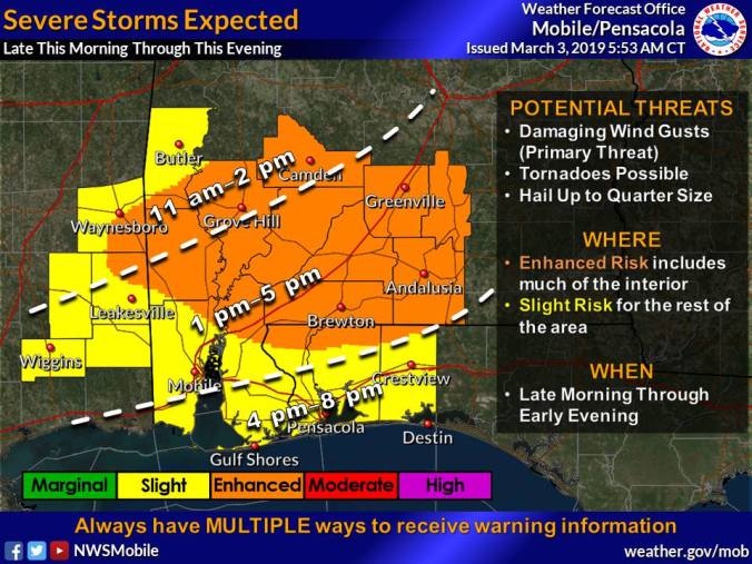
Severe storms are expected to move into this area late afternoon through the evening between 4 and 8 p.m. ahead of a strong cold front.
Some of the storms will be capable of producing damaging winds, hail and strong tornadoes.
Damaging winds will be the primary threat; however, a tornado threat remains possible with storms ahead of the main squall line.
Southwest winds will shift to the west at 10-to-15 mph in the afternoon. Winds could gust as high as 25 mph.
According to the NWS, there is a threat for up to a quarter-size hail in the strongest storms.
Rainfall amounts are expected up to half an inch with higher amounts during thunderstorms.
NWS forecast
