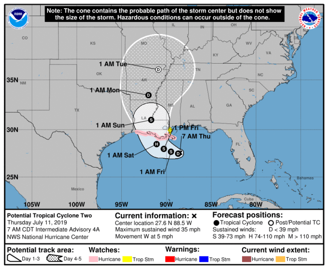
 HOLT, Fla., July 11, 2019—The morning National Hurricane Center update shows Potential Tropical Cyclone Two moving slowly westward in the north-central Gulf of Mexico.
Becoming better organized, sustained winds are at 35 mph with stronger gusts.
The NHC is forecasting PTC Two to become a tropical depression or storm later today and could become a hurricane by late Friday as it approaches the coast.
Hurricane watches are now in effect along the Louisiana coast.
According to the NHC, water is a primary hazard due to PTC Two.
Currently creeping along at 5 mph, the slow movement of this system will result in a long duration of heavy rainfall threat along the central Gulf coast and inland through the weekend and into early next week.
The system is expected to produce total additional rain accumulations of 10-to-15 inches with isolated maximum rainfall amounts of 20 inches.
 For this area, there’s a 70 percent chance of thunderstorms today with heavy rain forecast for tomorrow and 70 percent again Saturday before starting to taper off early next week.
Cloud cover and rains will keep the temperatures in the mid-to-high 80s through Monday.
 Out in the eastern Atlantic Ocean, a tropical wave is located several hundred miles southwest of the Cabo Verde Islands.
Slight development during the next day or two is possible while it moves westward at 15-to-20 mph before conditions become less favorable during the weekend, according to the NHC.
For now, further formation chances are at 10 percent.
