
HOLT, Fla., Oct. 18, 2019—The disturbance in the Gulf of Mexico is a little better organized and a tropical storm is expected to form today according to the National Hurricane Center.
Okaloosa County, as well as Santa Rosa, Walton and Escambia counties are under a tropical storm warning.
Potential Tropical Cyclone 16 is located about 540 miles southwest of Pensacola and 560 miles southwest of Destin moving toward the northeast near 21 mph.
According to the National Weather Service in Mobile, PTC16 is expected to gradually strengthen into a tropical or subtropical storm later today and be positioned over the north central Gulf of Mexico by late this afternoon.
It’s forecast to near the coast later tonight.
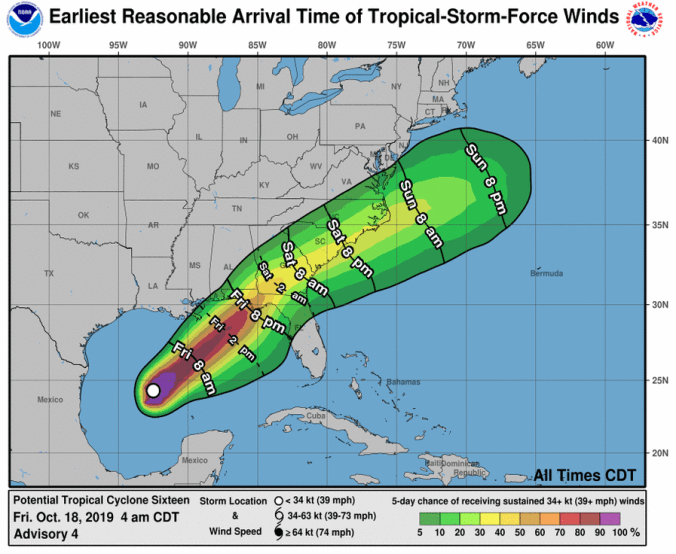 Tropical-storm-force winds extend outward up to 115 miles to the north and east of the possible center.
Maximum sustained winds along the immediate western Florida panhandle coastline will likely range between 35-to-45 mph with gusts up to 60 mph, according the NWS.
Rainfall amounts between 2 and 4 inches, with isolated higher amounts will be possible, especially in coastal areas south of Interstate 10.
According to the NWS in Mobile, because of the system, relatively limited impacts for the area are expected and quick movement of the system will greatly limit flooding potential.
Rain from this system will start to impact the coastal areas this morning.
Based on the forecast track, there’s still a chance many in this area will only experience chilly rain, according to the NWS.
Coastal conditions
A coastal flood advisory remains in effect with inundation of 1-to-2 feet expected tonight and Saturday morning, especially around high tide.
A high surf advisory is also in effect with breaker heights up to 5-to-8 feet developing this afternoon along area beaches and persisting into early Saturday afternoon.
Impacts
Potential impacts in this area include:
- Damage to porches, awnings, carports, sheds and unanchored mobile homes
- Unsecured lightweight objects blown about
- Many large tree limbs broken off
- A few trees snapped or uprooted, but with greater numbers in places where trees are shallow rooted
- Some fences and roadway signs blown over
- A few roads impassable from debris, particularly within urban or heavily wooded places
- Hazardous driving conditions on bridges and other elevated roadways.
- Scattered power and communications outages
National Weather Service in Mobile and National Hurricane Center forecasts
