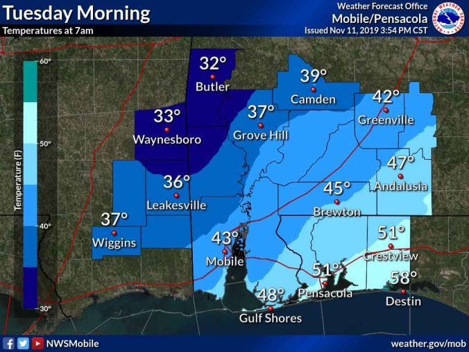
HOLT, Fla., Nov. 11, 2019—Widespread record cold temperatures are expected behind a strong cold front Tuesday and Wednesday according to the National Weather Service.
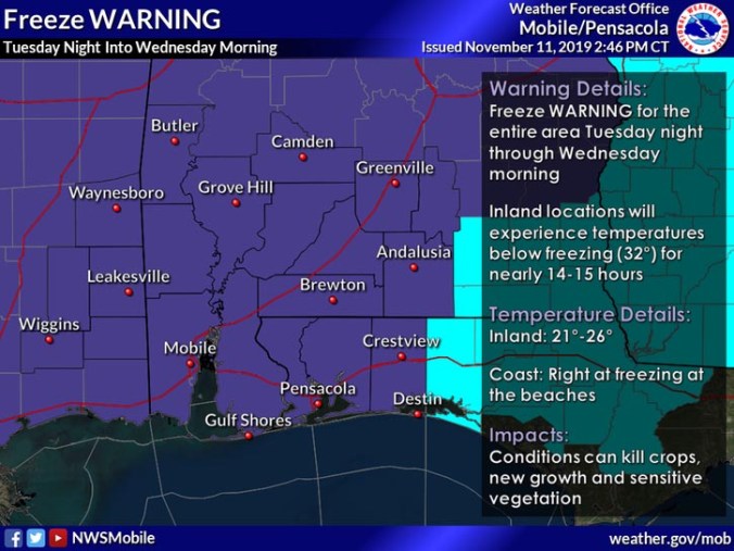
The entire Mobile NWS area is under a freeze warning from 6 p.m. Tuesday to 9 a.m. Wednesday.
Sub-freezing temperatures are forecast to fall into the 20s across much of the area with temperatures right at freezing along the immediate coast.
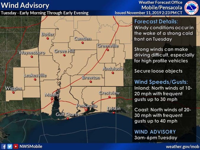
Additionally, a wind advisory is in effect from 3 a.m. to 6 p.m. Tuesday.
 Tuesday
Temperatures in this area are expected to get to a high of 51 tomorrow before they begin falling as the cold front pushes through.
Forecast low for this area Tuesday night is 27 degrees.
Precipitation
There’s a chance of showers here mainly between 9 p.m. and midnight, then rain is likely after midnight. Low temperatures for tonight are expected around 45 degrees.
Chance of precipitation tonight is 70 percent.
 Winds
Winds
It will be windy in the wake of the cold front, according to the NWS.
Tonight, south winds from 5-to-10 mph are expected to shift to the northwest and increase to 10-to-15 mph after midnight. Gusts could reach 25 mph.
A wind advisory goes into effect Tuesday for wind gusts up to 30 mph for inland locations and up to 40 mph along the immediate coastline.
Winds should gradually diminish with clearing skies Tuesday evening into the overnight hours, according to the NWS.
 Cold
Cold
Record or near-record low temperatures are expected Tuesday night into Wednesday morning with temperatures in the upper 20s-to-lower 30s.
Inland locations will experience temperatures below freezing for nearly 14-to-15 hours.
For this reason, a freeze warning is in effect for the entire area Tuesday night into Wednesday morning.
Wednesday’s high is 56 degrees with clear sunny skies.
 Wind chill
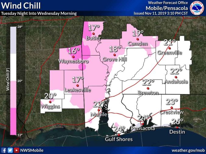
Winds combined with cold temperatures mean wind chill digits in the teens during the nighttime hours.
Wind chill temperatures will plunge into the teen-to-low 20s overnight Tuesday into early Wednesday.
Staff and NWS forecast
