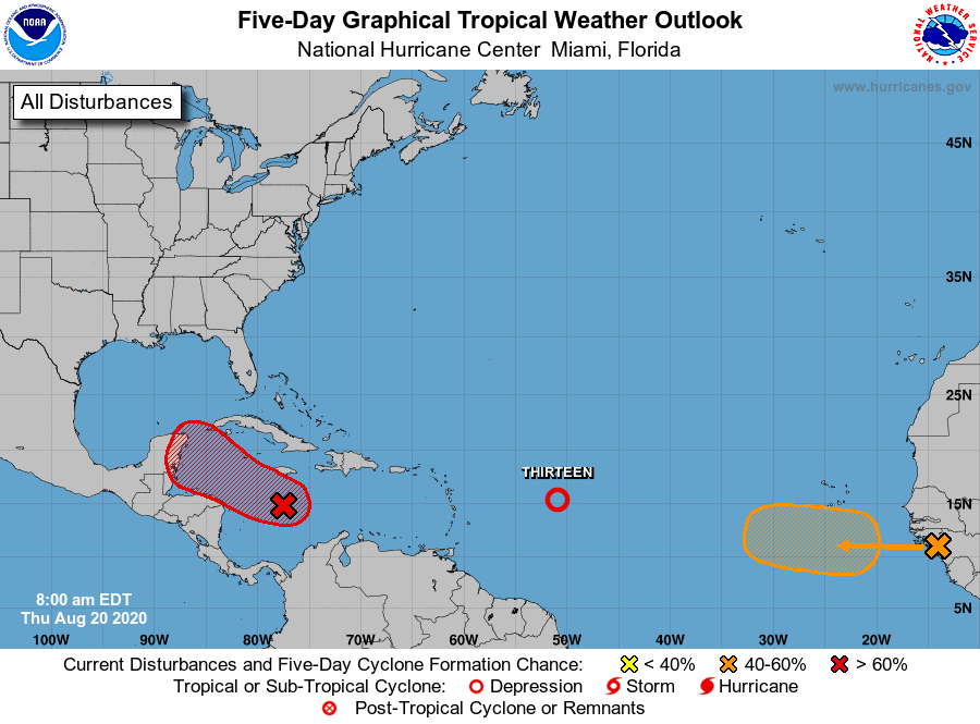
HOLT, Fla., Aug. 20, 2020—Tropical depression lucky number 13 formed in the Atlantic Ocean late last night.
Gradual strengthening of Tropical Depression 13 is forecast and the depression could become a tropical storm later today, according to the National Hurricane Center.
The next name on the hurricane list is Kyle.

The depression is moving west-northwest near 21 mph. Maximum sustained winds are 35 mph.
It’s expected to move near or north of the northern Leeward Islands by late tomorrow and near or north of the Virgin Islands and Puerto Rico Saturday.
According to the NHC, the environment looks generally favorable for strengthening with light-to-moderate wind shear during the forecast period.
Hurricane models are split about the long-range forecast. Some show TD13 intensifying into a major hurricane by day five. Others show the system degenerating into an open wave. Still others forecast something in between, according to the NHC.

The NHC five-day forecast shows TD-13 becoming a strong tropical storm.
For now, it’s too early to forecast when or where TD13 will go or what impact it will have on the United States.
Meanwhile, satellite imagery suggests circulation around the tropical wave traveling west-northwest in the Caribbean Sea toward the Yucatan Peninsula is becoming more defined, according to the NHC.
If those development trends continue, a second tropical depression could form later today or tonight as the system approaches the northwestern Caribbean, according the hurricane center.
This system now has a high 90 percent chance of formation.
And farther to the east, a tropical wave over Africa is expected to move over the ocean tomorrow and begin its west-northwest track across the warm waters of the tropical Atlantic.
Formation chance is medium at 40 percent during the five-day forecast period.
National Hurricane Center forecast
