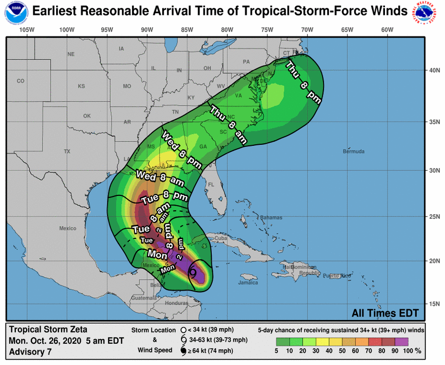
HOLT, Fla., Oct. 26, 2020—Tropical Storm Zeta is expected to be at or near hurricane strength when it reaches the northern Gulf coast Wednesday according to the National Hurricane Center.
Local impacts include heavy rainfall, gusty winds and possible tornadoes.
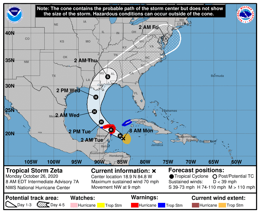
Zeta is forecast to become a hurricane this morning. Continued strengthening is likely until the storm moves over or near the Yucatan peninsula this evening.
The center of Zeta will move over the southern Gulf of Mexico tomorrow and approach the northern Gulf coast Wednesday.
Environmental conditions over the southern Gulf are forecast to be favorable for some re-strengthening as Zeta moves northwest over the south-central Gulf tomorrow, according to the NHC.
The NHC is expecting increasing wind shear and cooler northern Gulf waters will likely cause some weakening before Zeta reaches the northern Gulf coast as a category 1 hurricane or a strong tropical storm.
Zeta is moving toward the northwest near 9 mph.
A northwest motion with an increase in forward speed is expected during the next day or so, followed by a turn toward the north Tuesday night, according to the NHC.
A faster northward to north-northeast motion is forecast Wednesday.