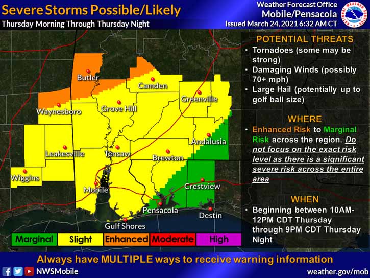
HOLT, Fla., March 24, 2021—Severe storms are possible during the day and into the night Thursday with a lower risk for this area according to the National Weather Service.
The risk level for this area has diminished, going from a level 2 to a level 1 (out of 5) with a lower threat of tornadoes and high wind.

Rain totals are forecast for 2-to-3 inches.
Areas to the northwest continue to be under a level 2 risk.
The strongest storms are forecast for north and central Mississippi and Alabama, generally the same areas as last week’s storms.
According to the NWS, any thunderstorm that develops has the potential to become severe.
As with last Wednesday’s storms, those higher risk areas may see strong winds in excess of 70 mph, large hail and tornadoes with this upcoming event.
Timing for the storms is between noon tomorrow to 8 p.m. in he evening.
Rain chances here continue into Friday with Saturday’s forecast as mostly cloudy. Rains return Sunday. Monday’s forecast is for clear skies with a high in the mid-70s.
National Weather Service forecast
