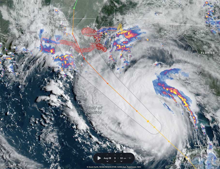
HOLT, Fla., Aug. 28, 2021—The center of Hurricane Ida is now over the very warm waters of the Gulf of Mexico.
Rapid strengthening is forecast and Ida is expected to be an extremely dangerous major hurricane when it approaches the northern Gulf coast late tomorrow.

Hurricane-force winds extend outward up to 25 miles from the center and tropical-storm-force winds extend outward up to 115 miles.
Ida is forecast to increase in size as it approaches the coast with the area of tropical-storm-force winds likely expanding further out to the east from the center before landfall.
There are no watches or warnings in effect for this area at this time. The tropical storm watch ends at the Florida-Alabama state line.

Ida will likely bring rainfall amounts of 3-to-4 inches here, with isolated higher amounts tomorrow into Monday and potentially extending into Tuesday.
Depending on the exact track of Ida after landfall, tropical-storm-force conditions, especially in frequent gusts, could occur over interior southeast Mississippi and portions of southwest and coastal Alabama.
The tornado threat will begin to increase tomorrow across portions of the western Florida Panhandle as the outer rain bands on the east and northeast side of Ida move into and across the area.
This tornado threat will likely persist and expand across much of the region into Sunday night and Monday.
Staff and National Weather Service Mobile forecast

Pingback: Ida intensifying as it moves northwest – Nelsapy