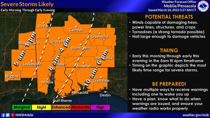
HOLT, Fla., March 18, 2022—The National Weather Service is calling for severe storms today across the entire forecast area.
Storms capable of producing large hail, strong winds and tornadoes are likely, including a strong, long-tracked EF2+ tornadoes with wind speeds between 111 and 135 mph.
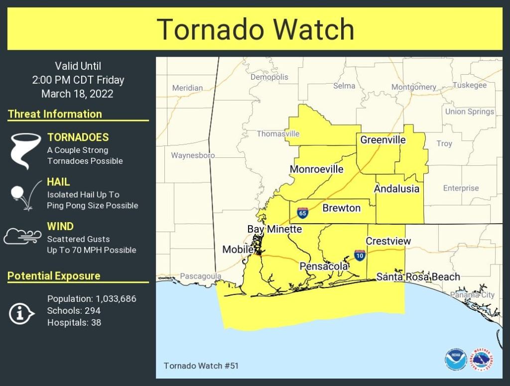
A tornado watch is in effect until 2 p.m.
The threat for the storms, which began across parts of southeast Mississippi and southwest Alabama this morning will gradually move east as the day progresses. Severe storms with a possible tornado moved through Alabama’s Baldwin County at 8:35 a.m. today.
According to the NWS, the threat for tornadoes will increase throughout the morning as a warm front surges north out of the Gulf of Mexico.
The severe threat will spread east through the morning and afternoon, shifting east of the I-65 corridor by mid-afternoon and exit the area by 6 p.m. or so.
National Weather Service forecast
