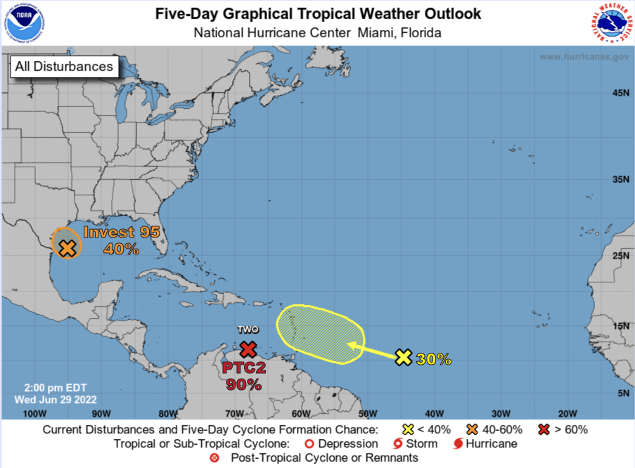
HOLT, Fla., June 29, 2022—The National Hurricane Center is watching three systems in the Atlantic Ocean and Gulf of Mexico.
Potential Tropical Storm Two has changed little today and radar indicates the system still does not show a definite center.
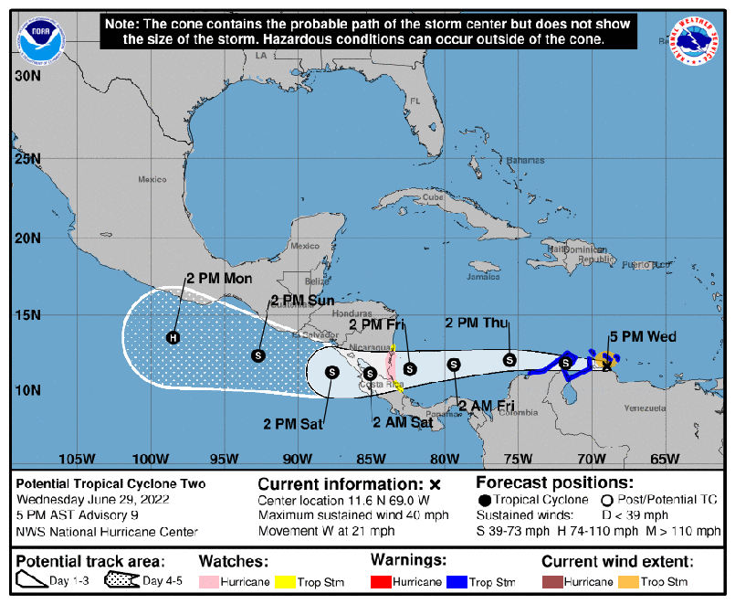

However, according to the NHC, it could make the transition to a tropical storm at any time and the system is expected to approach hurricane strength while over the southwestern Caribbean.
A National Oceanic and Atmospheric Administration Hurricane Hunter mission indicates the intensity remains near 40 mph.
The system is moving west near 24 mph and a west-northwest movement is expected through Friday.
PTC2 will pass near the southern Caribbean Sea today and over the southwestern Caribbean tomorrow and Friday, according to the NHC. The system is expected to be near Nicaragua by Friday night.

Invest 95, located in the northern Gulf of Mexico has a 40 percent chance of development.
Shower and thunderstorm activity has increased since this morning, but remains disorganized, according to the NHC.
Some development is still possible as it moves westward toward southern Texas and northeast Mexico.
It could become a short-lived tropical depression before it turns inland over Texas tomorrow, according to the NHC.
In the central tropical Atlantic, a tropical wave could show some slow development as it moves west during the next few days, according to the NHC.
However, further development is unlikely when it moves over the eastern Caribbean Sea by the weekend due to unfavorable environmental conditions.
