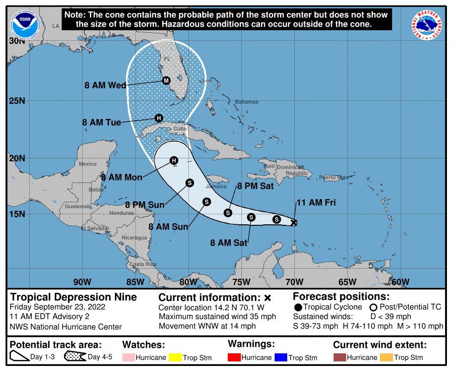
HOLT, Fla., Sept. 23, 2022— The National Hurricane Center upgraded Invest 98 to Tropical Depression Nine this morning and is forecasting it to develop into a major hurricane before it reaches Florida’s west coast next week.
Although some slow strengthening is forecast in the next day or two, TD9 is expected to become Tropical Storm Hermine by tonight.
High wind shear will prevent strengthening through early tomorrow, but once that shear decreases, more significant intensification is forecast, and the current forecast calls for rapid intensification as the system moves across the northwestern Caribbean Sea.
The system is forecast to approach Jamaica as a tropical storm Sunday and the Cayman Islands as Hurricane Hermine Monday.
By the time it nears Cuba, it will be a strengthening hurricane with additional intensification as it emerges over the warm waters of the southeastern Gulf of Mexico, according to the NHC.
The system is expected to approach the Florida peninsula at or near major hurricane strength, with the potential for significant impacts from storm surge, hurricane-force winds and heavy rainfall.
Meanwhile, the tropical wave off the coast of Africa is now Tropical Depression 10 and could become a short-lived Tropical Storm Ian during the next day or so before weakening later this weekend, according to the NHC.
And further out in the central tropical Atlantic, some slow development of a tropical wave is possible during the next several days as it drifts west or northwest.
NHC forecasts
