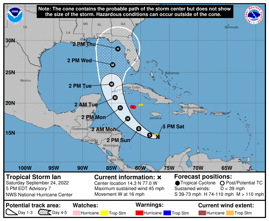
HOLT, Fla., Sept. 24, 2022—The 5 p.m. National Hurricane Center update puts the Florida panhandle in the five-day cone.
As a result, the National Weather Service in Mobile is forecasting tropical storm conditions are possible here Wednesday night.
The latest information from the National Hurricane Center indicates Tropical Storm Ian will rapidly intensify once it enters the Gulf of Mexico.
Intensity forecast is now at 130 mph forecasting Ian to possibly build to a category 4 storm before weakening back to a category 2 due to some wind shear near landfall somewhere along the Florida Gulf coast.

According to the NHC, uncertainty in the track forecast is higher than usual.
The latest westward track forecast this afternoon adjusted the five-day cone of uncertainty from Pensacola to Fort Myers, placing nearly the entire state of Florida in the cone.
Due to the increased uncertainty in the track forecast in the three-to-five day period, further adjustments may be needed, according to the NHC.
As a result of this afternoon’s forecast, Gov. Ron DeSantis has declared a state of emergency for the entire state of Florida due to the possibility of dangerous storm surge, heavy rainfall, flash flooding, strong winds, hazardous seas and isolated tornado activity.
Ian is expected to significantly strengthen during the next few days as it moves into a low-shear environment and over warm waters in the northwestern Caribbean Sea.
The 5 p.m. update is predicting Ian to become a hurricane by late tomorrow/early Monday and become a major hurricane by late Monday/early Tuesday.
The next NHC cone update will be at 7 p.m. CDT.

Pingback: Hurricane Ian forms; potential for life-threatening surge | Holt Enterprise News