HOLT, Fla., July 19, 2026—Tropical Depression Two has formed off the west coast of Florida.
The low-pressure area the National Hurricane Center has been monitoring for the past few days has developed a well-defined low-level circulation.
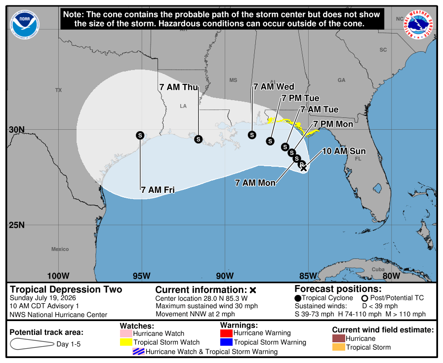
TD2 is expected to move along the northern Gulf coast during the next several days. It is moving west-northwest near 2 mph with an expected turn to the west in a day or two.
It is forecast to become Tropical Storm Bertha tonight or tomorrow as it nears the panhandle. Dry air and wind shear nearby should slow down any strengthening in the short term, according to the NHC.
By day three, TS Bertha could reach 60 mph wind strength, keeping it a tropical storm before it makes landfall at a point yet to be determined.
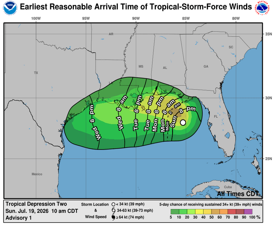
According to the NHC, the system will likely be close enough to the panhandle to bring the potential for tropical storm conditions before turning to the west or west-northwest.
Because of this, a tropical storm watch has been issued for Florida from the Ochlockonee River to the Alabama border.
An Air Force Reserve Hurricane Hunter mission is scheduled to investigate the system later today.
National Hurricane Center forecast
 Holt Enterprise News