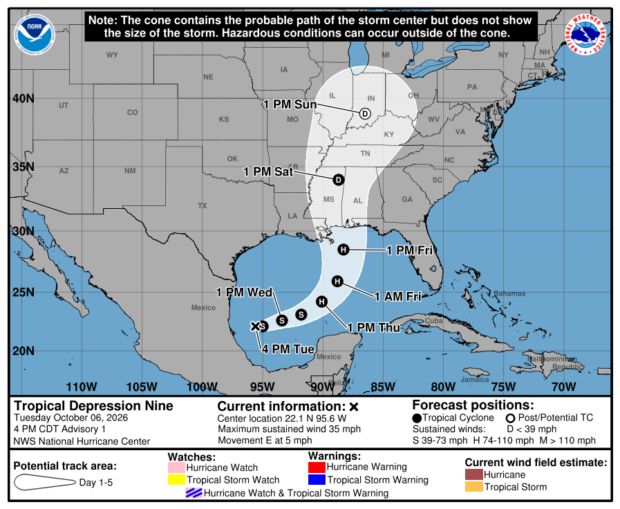
- Tropical Depression Nine is expected to strengthen quickly
- Local hurricane impacts are possible into the weekend
HOLT, Fla., Oct. 6, 2026—The National Hurricane Center has designated the tropical low pressure area in the southwestern Gulf as Tropical Depression Nine.
The system is expected to strengthen quickly, bringing hurricane impacts to the northern Gulf coast possibly for this weekend.
Environmental conditions are generally favorable for strengthening during the next few days with very warm Gulf waters feeding the system.
The NHC is forecasting TD9 to become a Tropical Storm Isaias by early Wednesday and a hurricane Thursday.
The storm could weaken before reaching the coast due to increased wind shear, but it is still expected to be a dangerous hurricane when it makes landfall, according to the NHC. For now, peak forecast winds are at 100 mph making it a category two storm.
Regardless of how intense the storm becomes or where it makes landfall, it will bring dangerous winds and heavy rain to this area with flash, urban and river flooding possible.
The system is forecast to track slowly east to east-northeast during the next couple of days toward Mexico’s Yucatan Peninsula.
By Friday, it is expected to make a sharp turn to the northeast before moving north toward the upper Gulf coast.
According to the NHC, “there is significant uncertainty in where the system makes the northeast turn and how fast it moves toward the coast.” The stronger the system gets, the faster it will move toward the coast, according to the forecast.
Should the current forecast track hold, the northwest Florida panhandle area will be on the east side of the storm, also known as the “dirty” side. However, this forecast will likely move either east or west as the system gets closer to the coast.
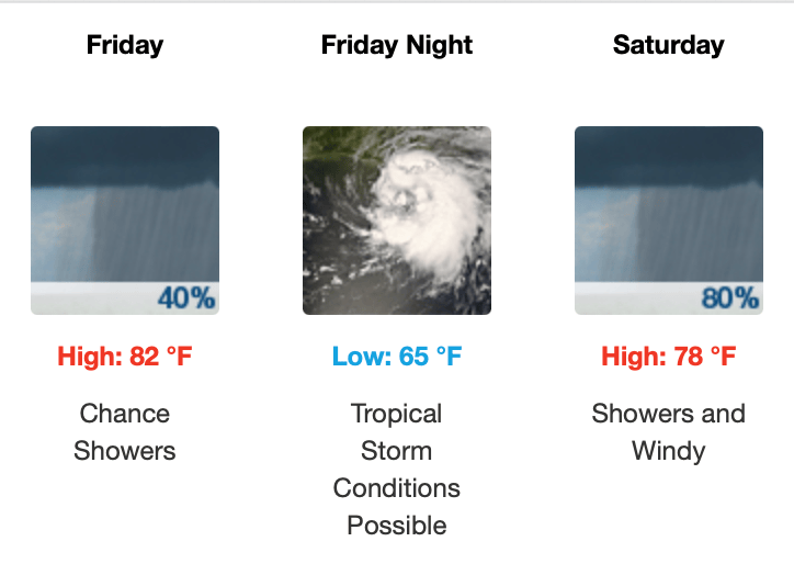
According to the National Weather Service Mobile forecast, tropical storm conditions are possible Friday night, including heavy rain, training thunderstorms, gusty winds and possible tornados.
Staff and National Hurricane Center forecast

