The National Hurricane Center has shifted the three-day cone east and now includes Holt and Crestview. (NHC)
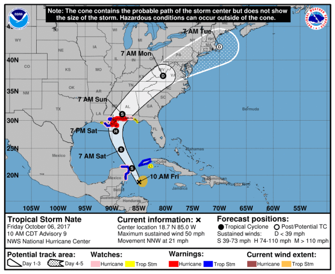
HOLT, Fla., Oct. 6, 2017, 11:30 a.m.–Tropical Storm Nate has shifted slightly to the east again this morning.
As a result, the National Hurricane Center has included the Holt and Crestview areas in the three-day cone of predicability.
Hurricane watches have been issued for areas east of the Alabama-Florida border to the Okaloosa-Walton county line.
Nate has picked up speed and is now moving north-northwest at 21 mph and is expected to enter the Gulf of Mexico tonight. The NHC expects the storm to continue on this path through Saturday with a turn toward the north and northeast Saturday night and Sunday.
Wind speeds have increased to 50 mph, according to Hurricane Hunter aircraft information. Additional strengthening is forecast during the next couple of days and Nate is expected to become a hurricane by the time it reaches the northern Gulf of Mexico.

Holt and the surrounding areas now have a 70 percent chance of receiving tropical-storm-force winds Saturday. (NHC)
