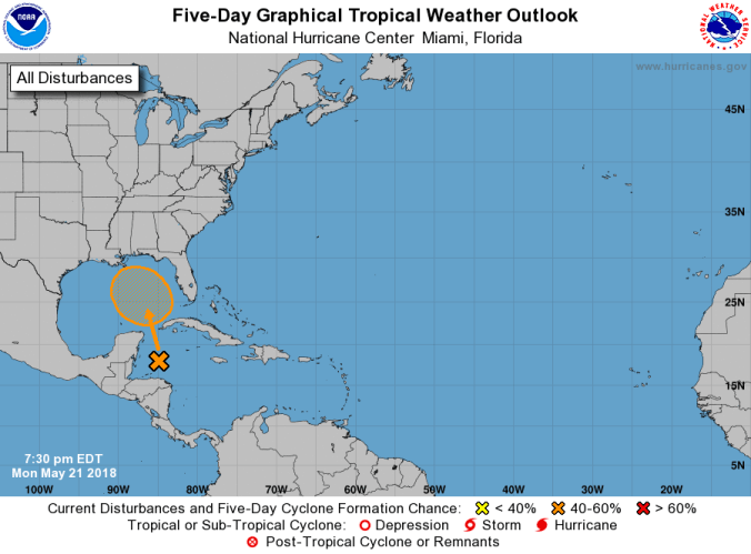
 HOLT, Fla., May 21, 2018–The National Hurricane Center is watching a new disturbance in the Caribbean Sea.
With a little more than a week to go before the official start of the 2018 hurricane season, this is the second spot the NHC has identified this month.
A broad surface low-pressure area formed over the northwestern Caribbean Sea a couple of hundred miles east of the coast of Belize has a 40 percent chance of further development during the next five days, according to the NHC.
This low and an upper-level trough are producing widespread cloudiness and showers extending from the northwestern Caribbean Sea across Cuba and the Florida peninsula.
While environmental conditions are expected to be unfavorable for development during the next couple of days, some gradual subtropical or tropical development is possible later this week while the system moves slowly northward into the central or eastern Gulf of Mexico.
Should this system mature, it will become Tropical Depression One or Tropical Storm Alberto, the first name on the 2018 hurricane list.
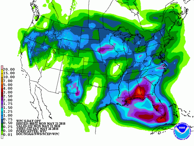
Rain impact from this system is likely to bring locally heavy rainfall later this week.
Regardless of development, locally heavy rainfall is possible across western Cuba and much of Florida during the next several days, according to the NHC.
The next special tropical weather outlook on this system will be issued by 8 a.m. EDT
Tuesday.
National Hurricane Center forecast
